Hiking The Wild Pukaskwa Coastal Trail
A 5 day journey along the rugged coast of Lake Superior
A 5 day journey along the rugged coast of Lake Superior
The Pukaskwa Coastal Trail highlights Lake Superior's wild beauty. It was developed in the 1980's by Parks Canada and today is a 60km trail with epic shoreline views.
The terrain and light traffic make this a difficult trail. It should not be your first overnight hiking experience. The Lake Superior waters are cold year round and it tends to create it's own weather systems.
With challenging weather the conditions could become slippery and dangerous. It is 60km linear, with the option to hike 120 km, end to end or hire a boat shuttle to drop you off a the Southern trailhead and hike back to Hattie Cove. Doug with North Shore Adventures can drop you off at the South end, most people do this and hike North Bound. The boat picks you up dockside at the Hattie Cove campground visitor Centre.
Getting There:
- Pukaskwa is remote. Plan your travel, the closest reasonable airport is Thunder Bay and it's still 300km away. It's an 8 hour drive from Sudbury.
- Marathon is the closest community, sitting just beyond the park border.
- The Hattie Cove campground is ideal for a stay before or after your hike. It has excellent showers. Sites are chosen on arrival, they don't accept reservations in 2025.
- Parking is available at the Hattie Cove Visitors center where the trail begins, and where the boat picks you up
Sites
There area 25 backcountry campsites scattered at 12 locations along the trail. Most locations have a cluster of 2-3 sites with a shared bear bin and bathroom facilities. Most sites are on the shores of Lake Superior in protected bays.
Reservations
National park reservations come available one day in March. Look it up and plan to be online. When we logged on 4 hours after reservations became available and weren't able to get all our first choice sites.
If you plan to hike South to North you will also need to reserve your boat shuttle in advance.
Safety
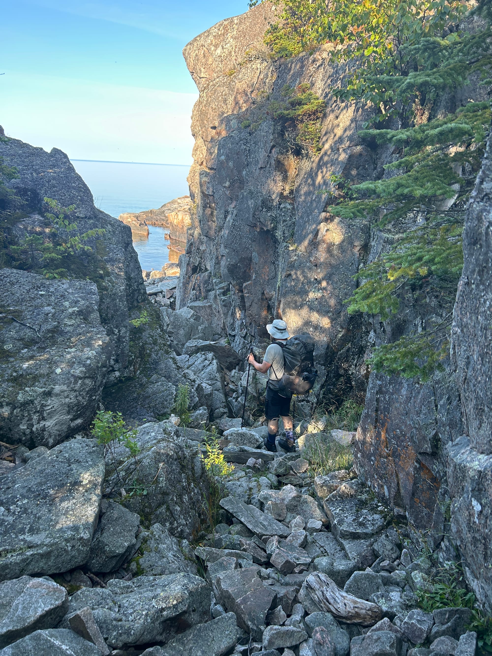
Pukaskwa is remote. The terrain is challenging. There is no cell reception at the park or on the trail. You must be self sufficient, I recommend a satellite communication device for emergencies. There are lots of rocky bits and boulders. Hiking poles are recommended.
There is a mandatory safety briefing before hiking and they are offered via an online session ahead of time. The briefing managed to convey one message to us; There are bears in Pukaskwa. Be aware.
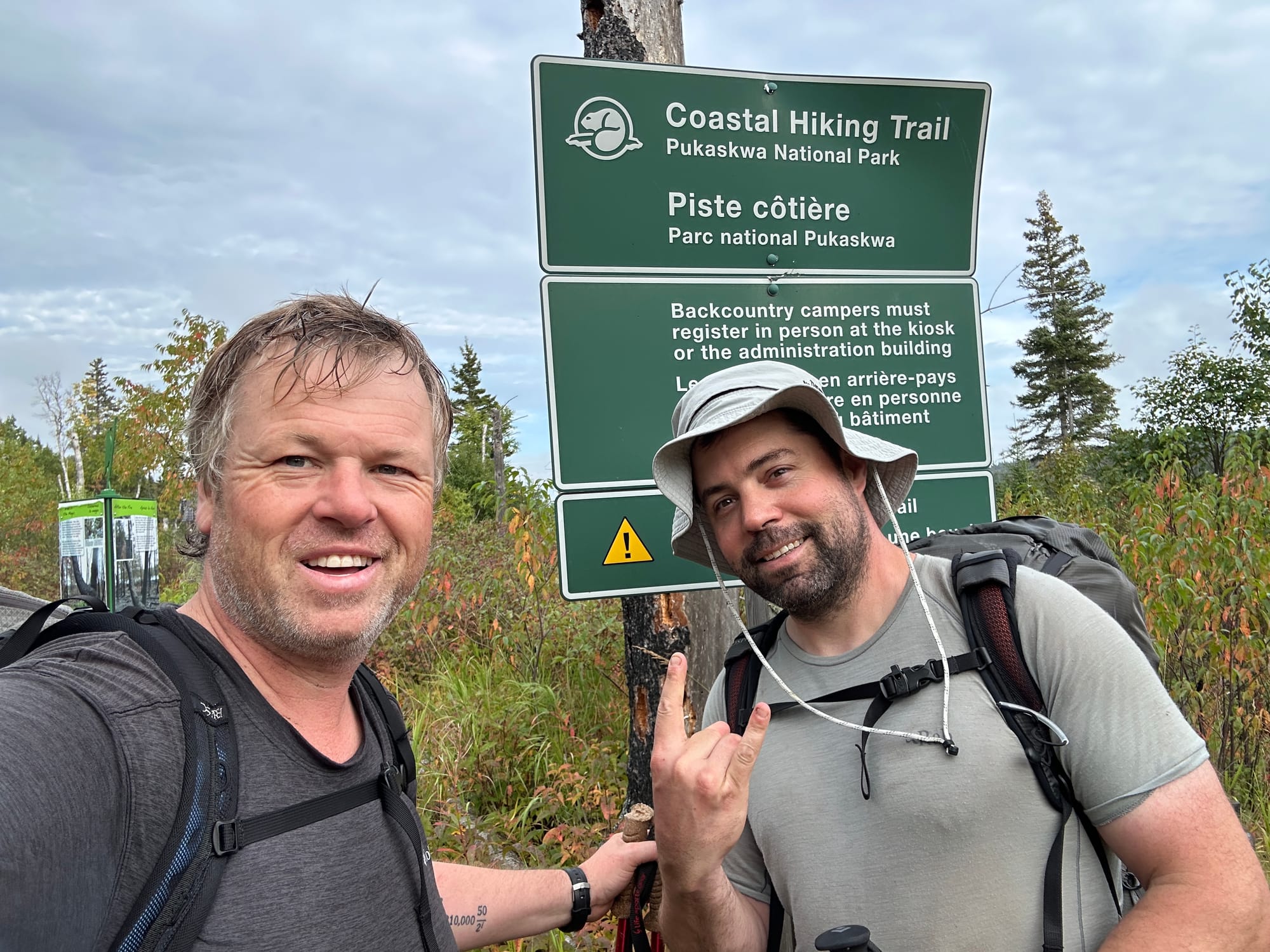
I had my standard hiking gear with a pack weighing in at 35lbs. We chose to stay over at the Hattie Campground the night before and were set for an early start with a 7am pickup.
Day 1 Hattie Cove to Hideaway Lake
Distance: 4.4km hiking
Hiking time: Less than 2.5 hrs
We kicked off with a boat ride to the southern trail head. Doug picked us up at the steps of the Hattie Cove visitors center. It was a calm day on Lake Superior but but we still had 4 ft swells. His boat the White Knuckle was appropriately named, I spent the ride hanging on so I didn't go flying.
We were dropped off with another duo who was also on their annual hiking trip. We are only scheduled for 4.5km so started with a hot coffee on the beach and our Apple Fritters (If you drive to Puk, stop from some fritters)

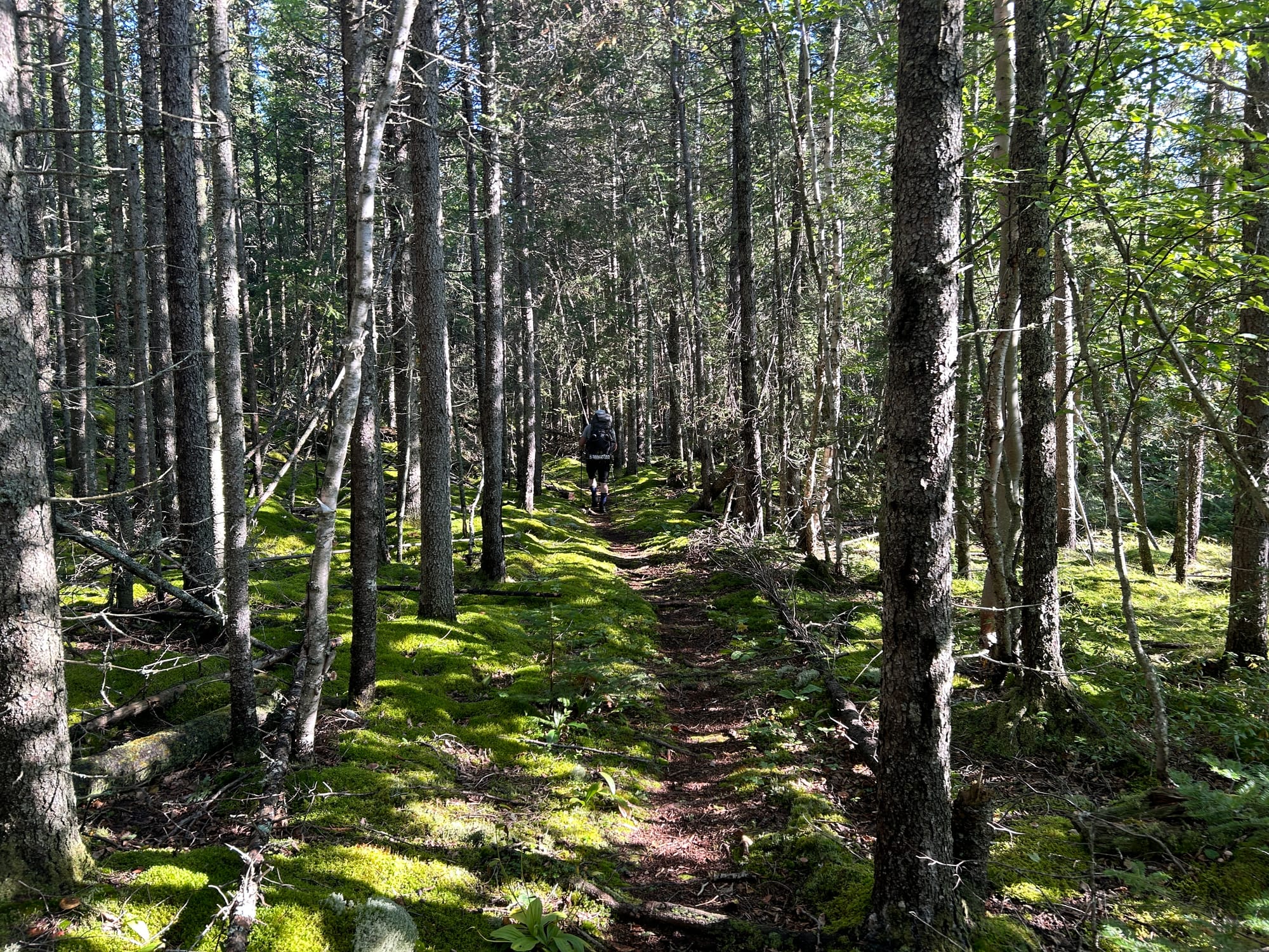
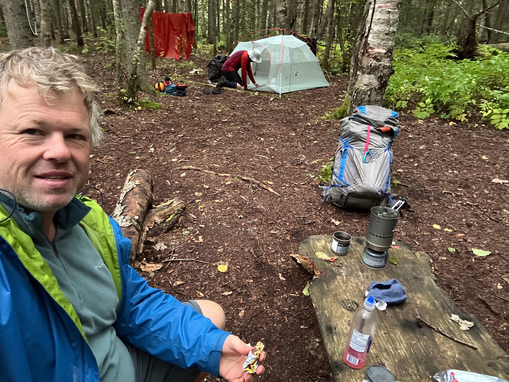
All too soon we got on the trail. We immediately found ourselves rock hopping across the river and had one false turn early on but we quickly tuned into our trail sense. There was moderate hiking mostly in the trees on day 1. We arrived at Hideway Lake in the early afternoon. The sun was out with a nice breeze to dry out the dew on our tent. We set up camp and prepared from possible rain that night.
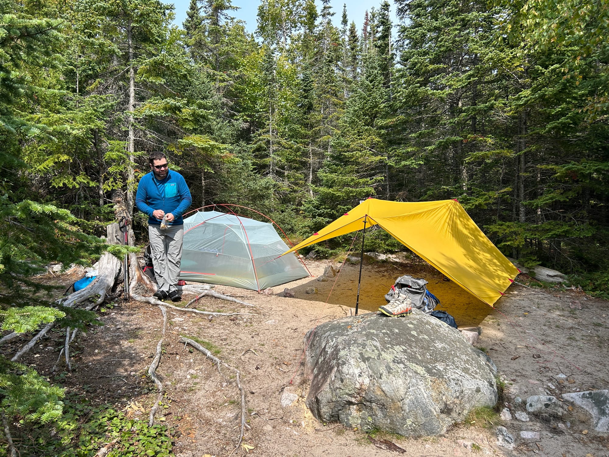
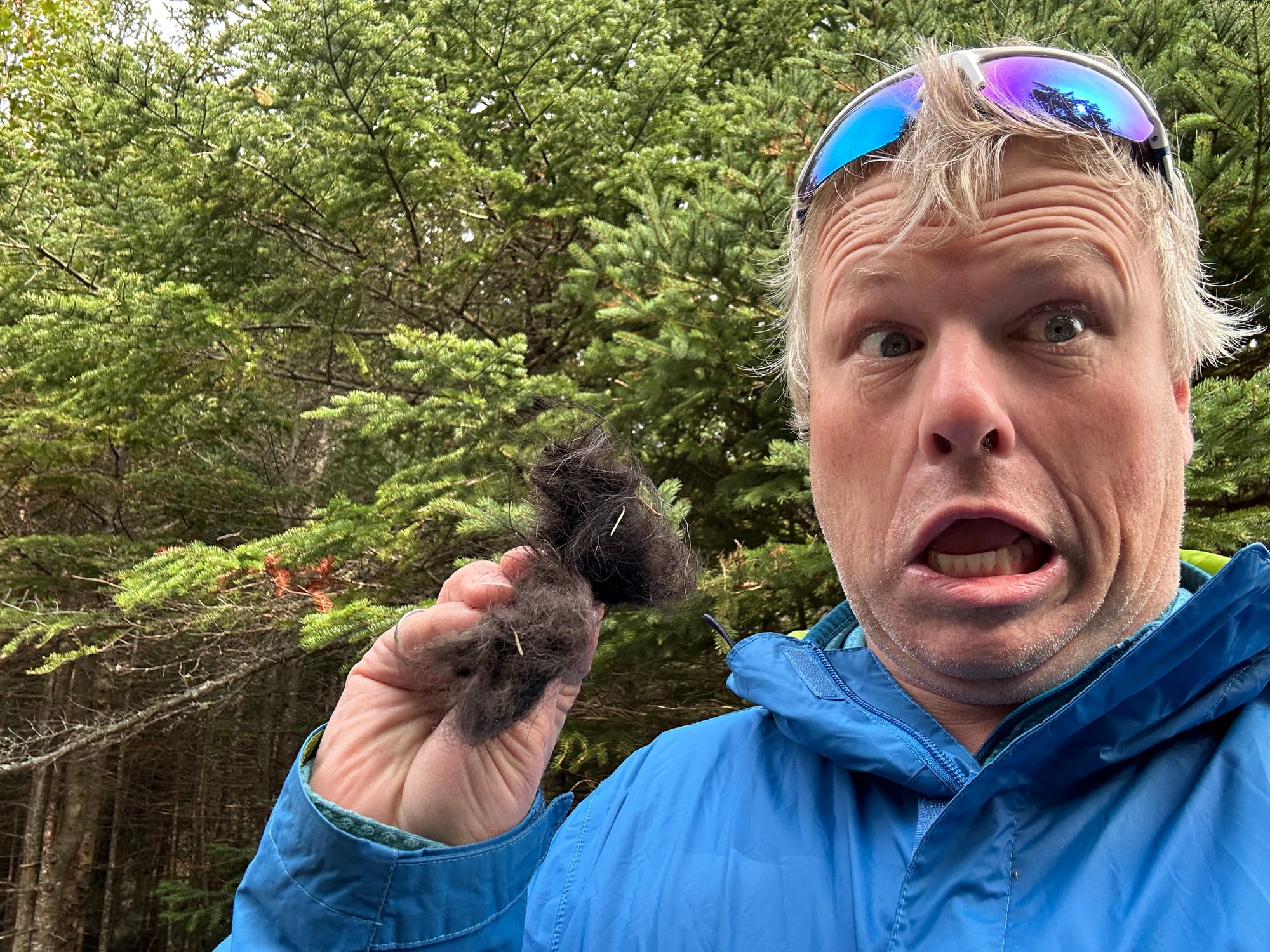
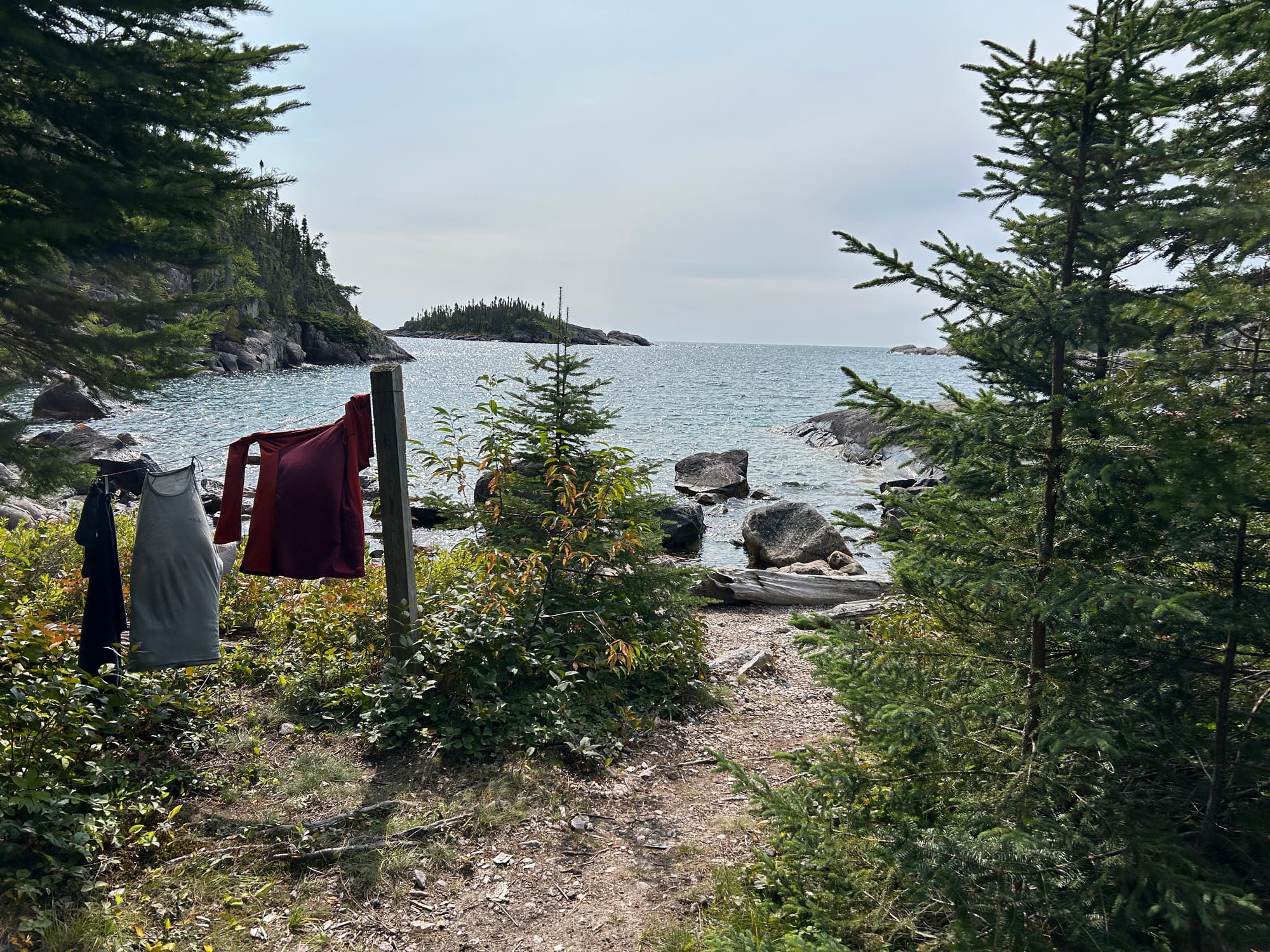
While gathering deadfall for the campfire I had to shoo a bear out of camp. He was just passing through and we encouraged him to keep going. Each site has a metal bear bin a little ways from the site for all food to be stored at night. We enjoyed some shore line views and as the temperature dropped we lit the campfire and played a game of cribbage.
Day 2 - The Lost Day
Hideaway Lake to Fishman's Cove - 17.2km
Travel time 8.25 hrs
People seen - three
The lost day as far as photos go. No photos were taken the entire day. It started raining late night on Monday and continued into the morning of Day 2. The weather report we were able to pull called for rain off and on until late afternoon. We broke camp in the rain, secured ourselves as best we could and got on the trail. We were soaked within minutes.
There was a mix of coastal hiking and inland. The forest didn't have those slippery rocks but the tradeoff is the trail becomes a bit of a stream/run off on a rainy day. We were soaked ALL day. Stopping for a break got cold, so we just hiked. We had our path blocked by downed trees, leaving you to hop over or often crawl under to get passage. It was slow progress most of the time.
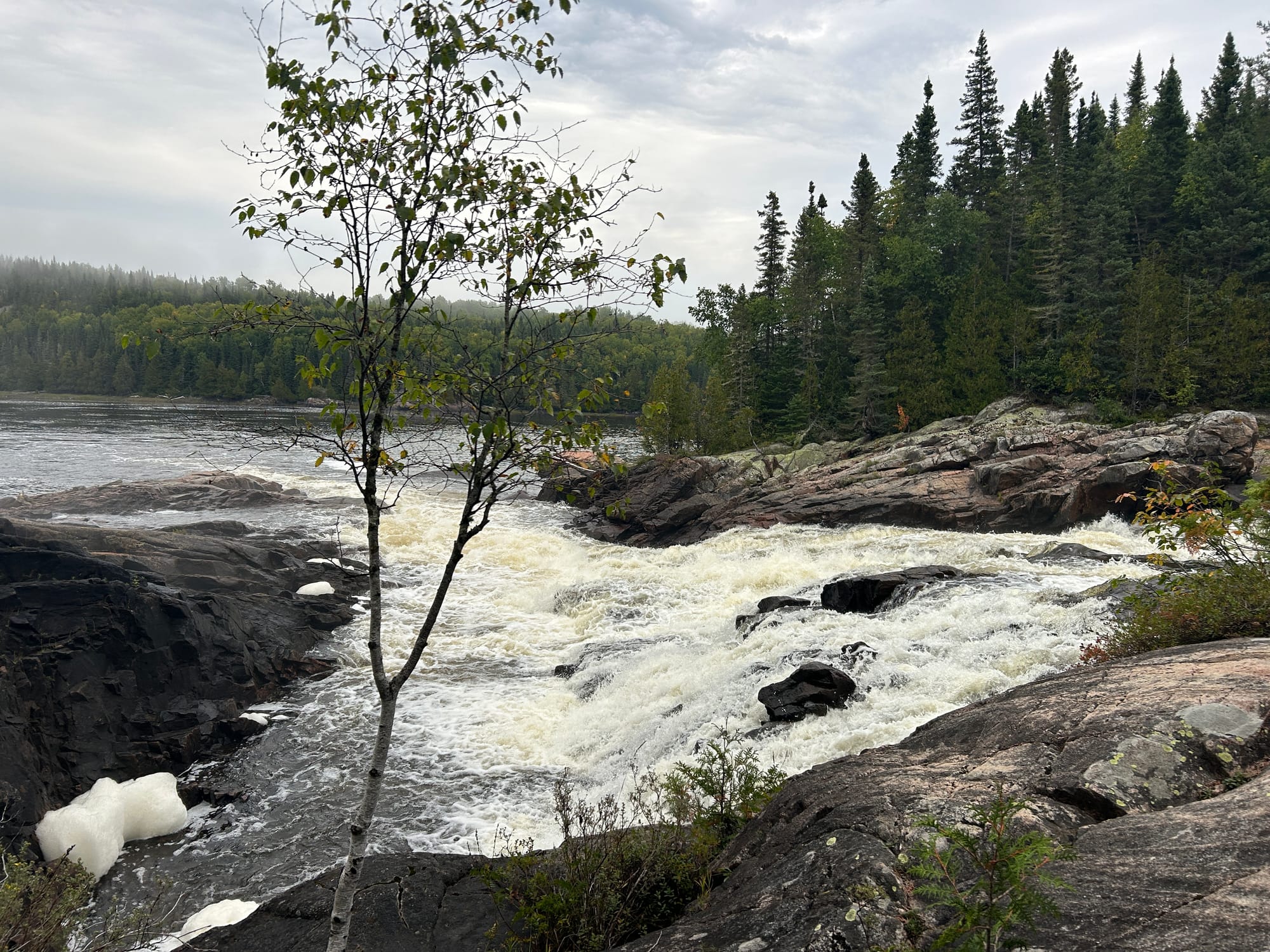
The day was broken up with the Gravel River in the afternoon. The trail ran directly into it, continuing on the other side of the bank.
'You don't suppose there is a bridge we don't know about? Do they think we are going to swim across this?'
It was still raining at this point and the river was frothing with all the run off flowing into Superior. We wondered what the safest option was and eventually crossed closer to the shoreline where there was a bit of a sandbar and the current wasn't as strong. It was a little over knee height but was over quickly. Shortly after that we were sent back into the woods for the last 7km of the day. By then the trail was flooded out in places and had water running everywhere.
Around 3 in the afternoon when morale was waning, we encountered a lone South Bound hiker who looked equally as soaked as we felt but he was in good spirits and wished us good luck.
We felt grateful when just after 5pm we arrived at Fisherman’s Cove campsite and wasted no time setting up tarp/tent and changing into some dry clothes. I jumped into my warmest clothes and only emerged for a brief bite to eat. I was spent from the day and cold to the core from the rain. I fell asleep to the sound of the rain, it stopped sometime overnight.
Day 3 - The Shores
Fisherman’s Cove to Fish Harbor
Distance 13km
Travel Time - 7hrs
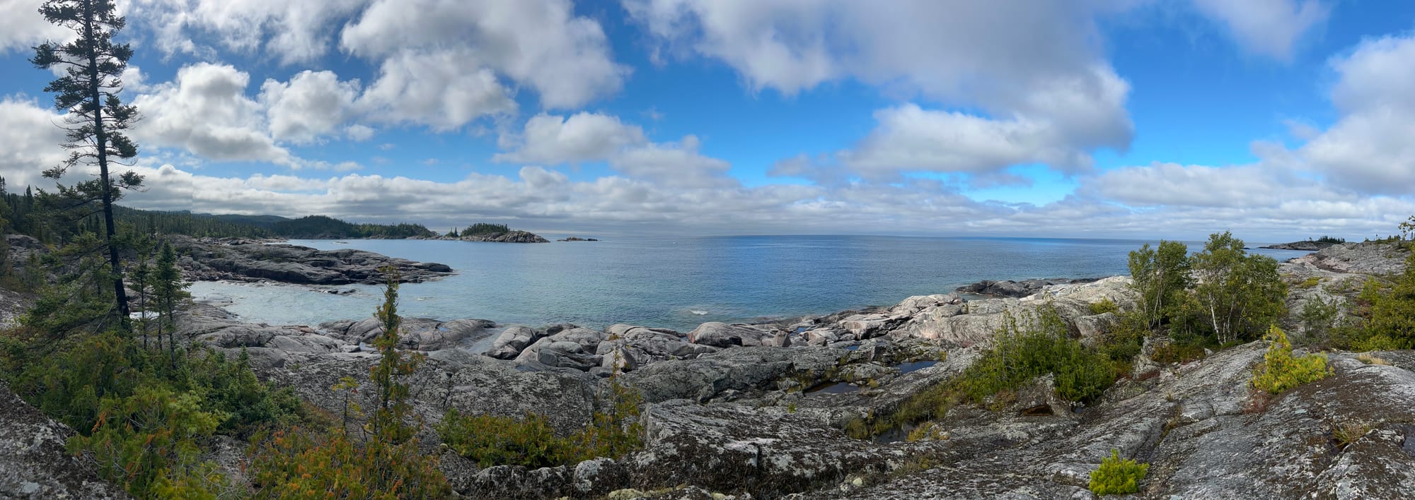
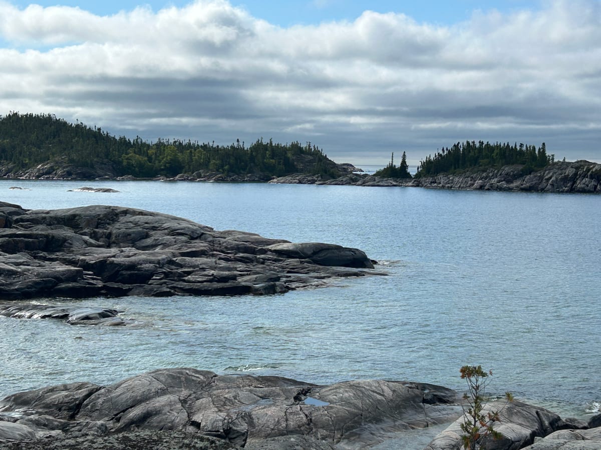
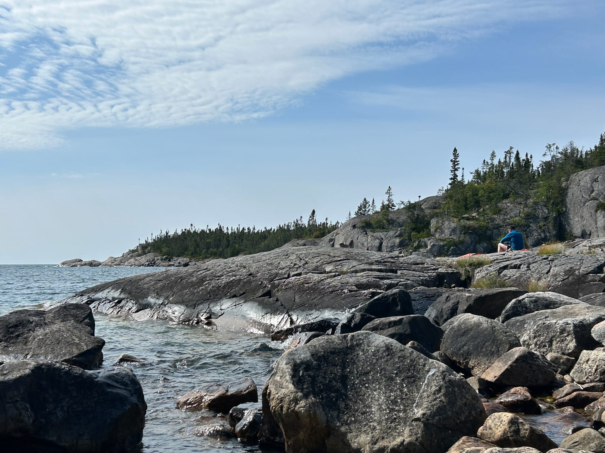
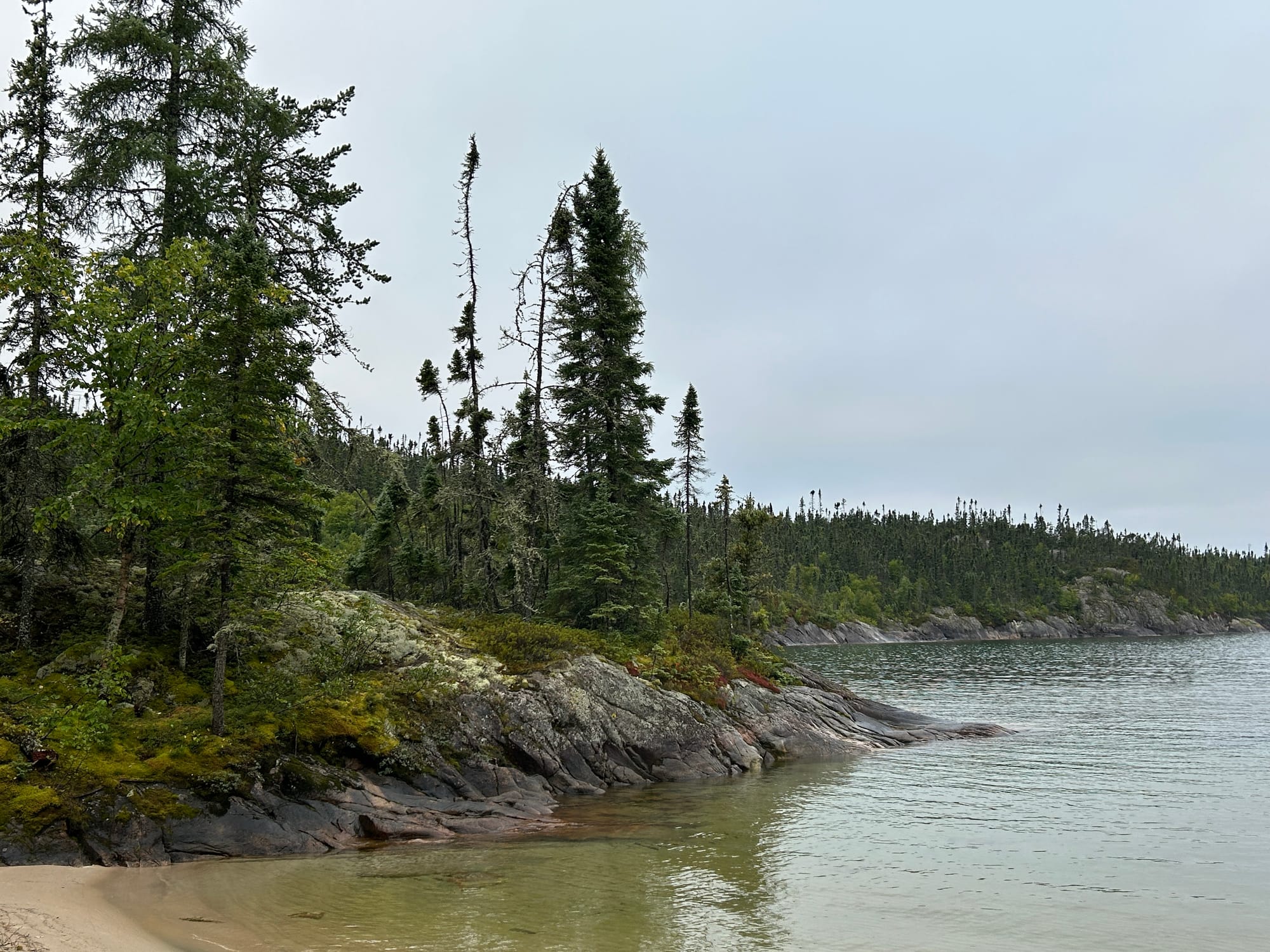
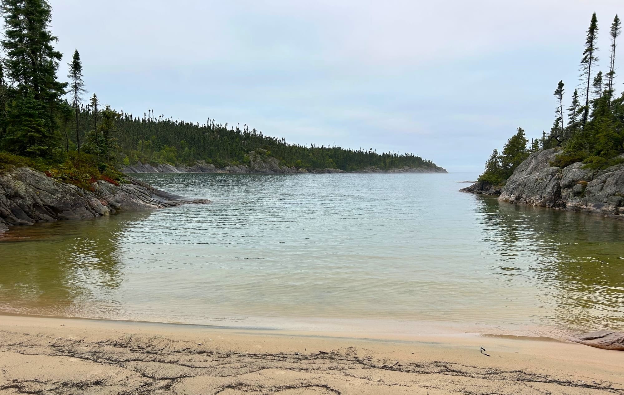
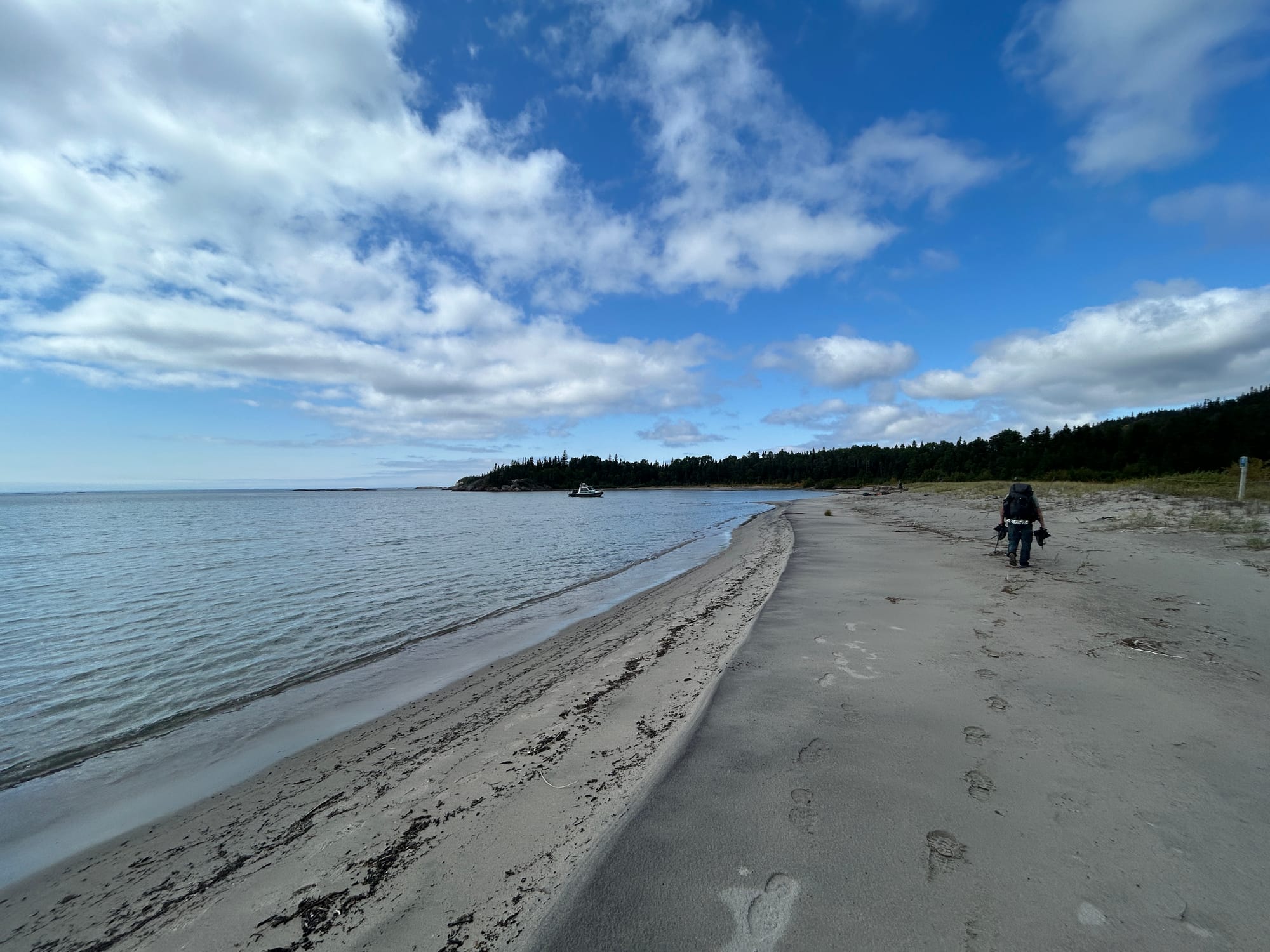
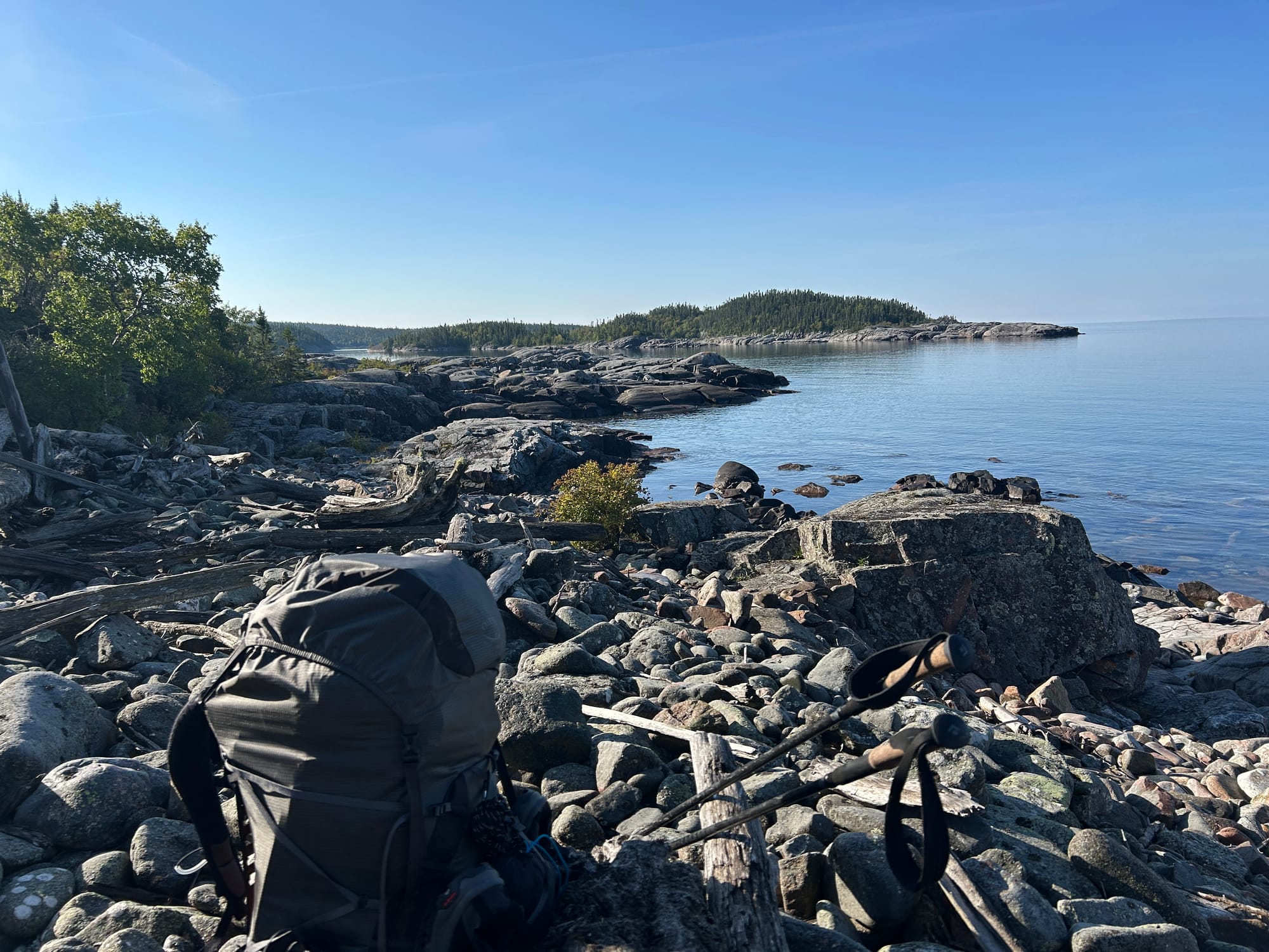
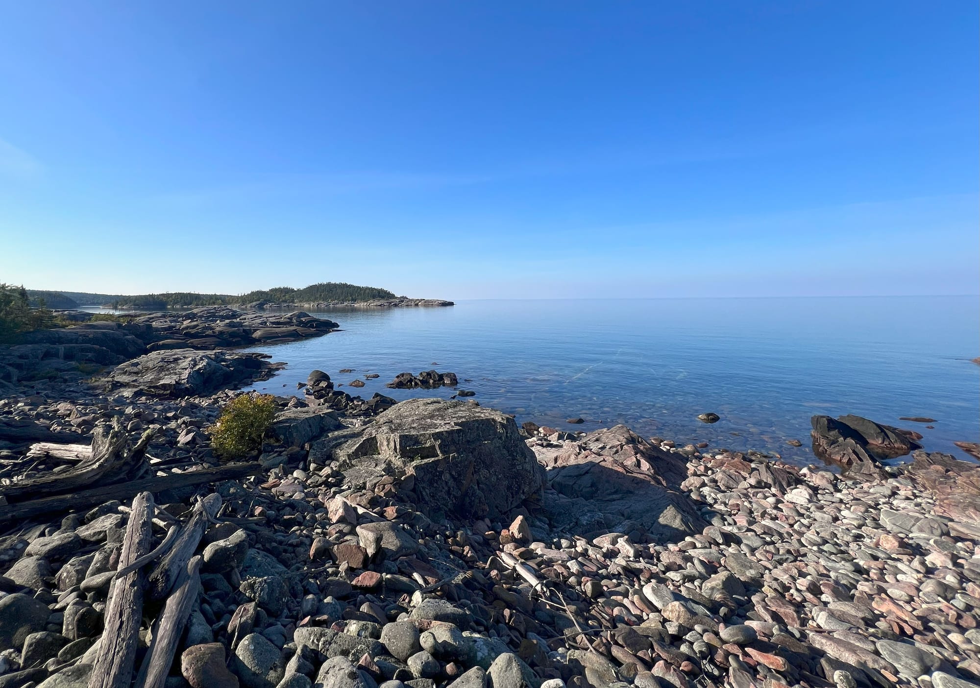
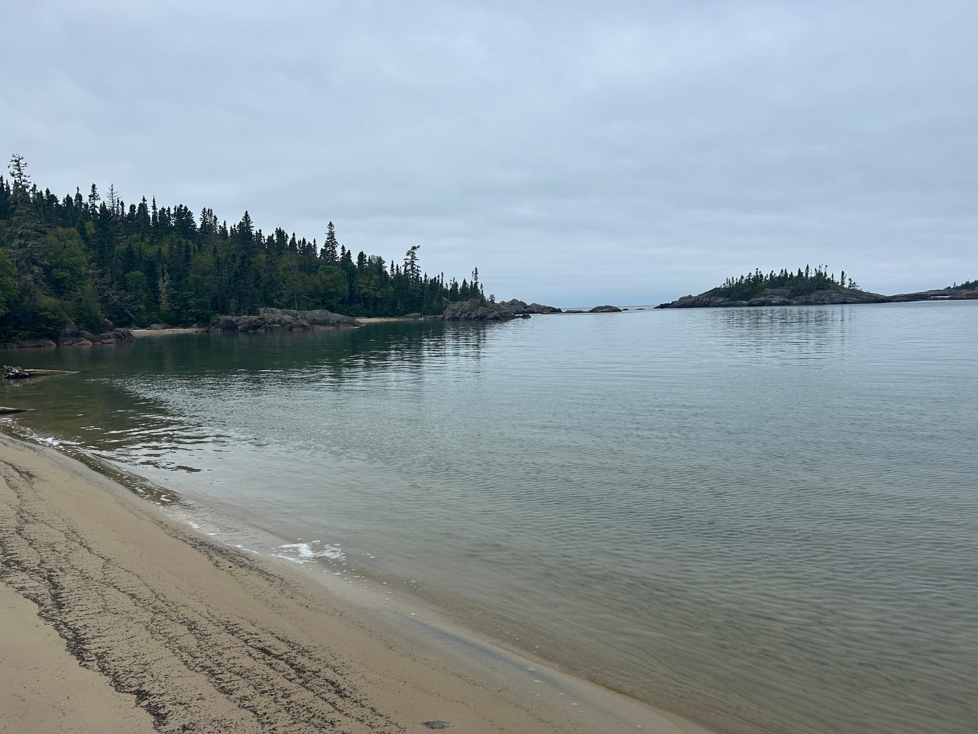
We went to bed to the sound of rain hitting our tarp, hoping things would be drier the next day. It was still a little dreary in the morning but we were able to put away our rain pants and jackets. The trail was still damp but without rain falling from the sky, morale was much improved. By mid morning there was blue sky above us. This stretch had some of the prettiest coastal views we would get. We agreed, the rock hopping and clambering on this section would have been treacherous in the rain.
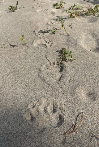
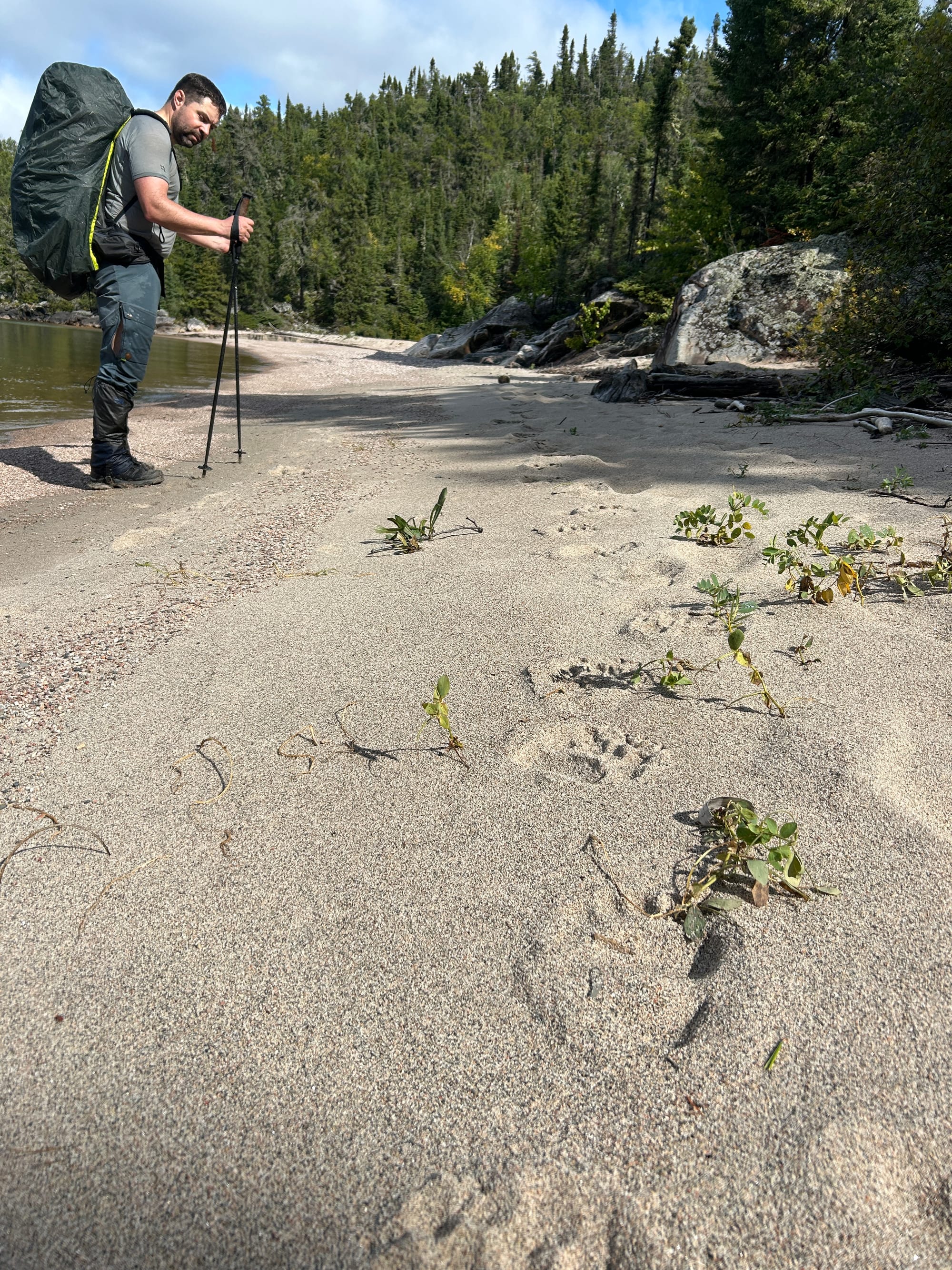
Every bend in the coastline would reveal a new view. We went over rocky climbs and through the occasional sand bay. On these stretches of beach walking we could see plenty of fresh bear prints. We saw them all morning whenever the ground was soft. Was the bear also hiking the Coastal Trail Nobo?
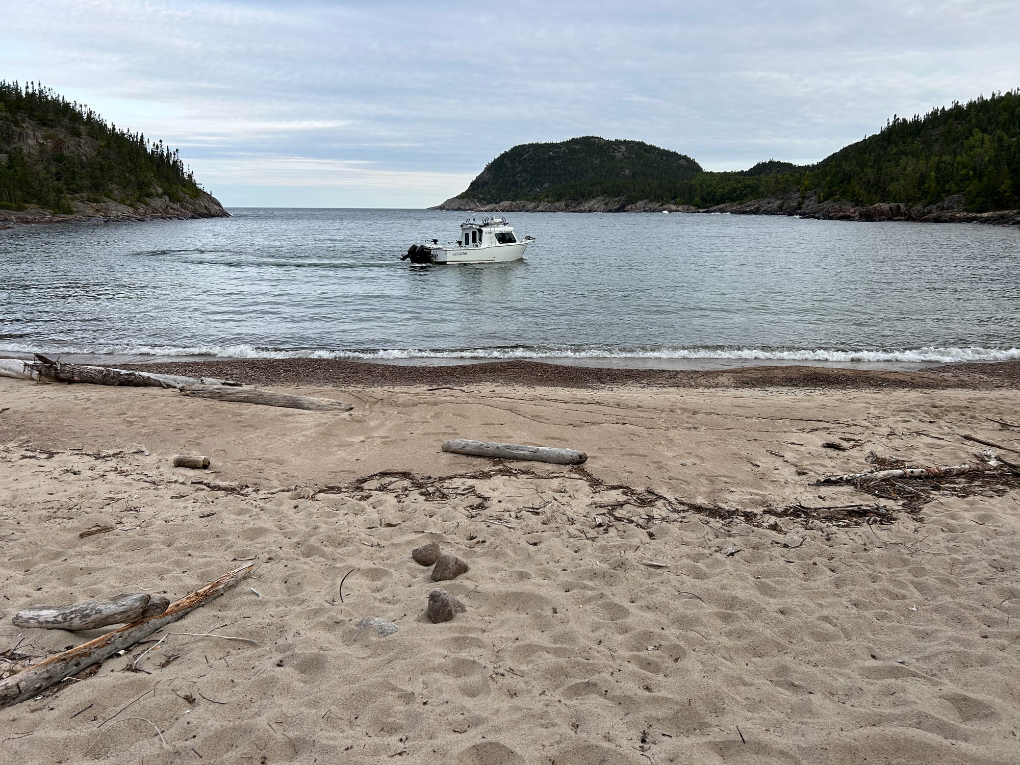
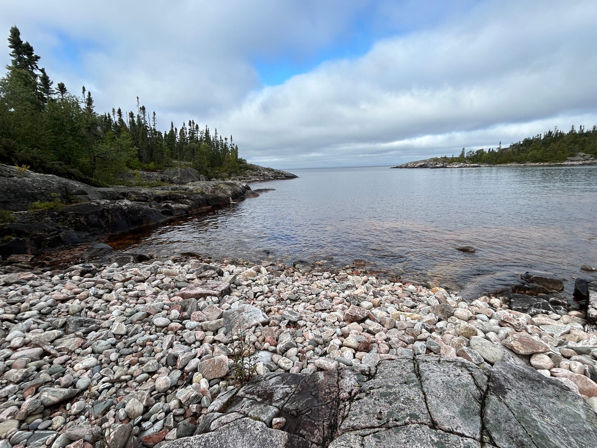
There were a couple of crossings that had us leaping bank to bank in a hope of staying dry. Then we came into Oiseau Bay. Around midday arrived onto a long sandy beach, it was Oiseau Bay which marks the halfway point on the trail.
There was a Parks Canada boat in the bay with several workers. This area has an endangered thistle they like to study. We counted 3 women who informed us they had taken a count of the thistle and planted some more seedlings and were reinstalling some barriers to keep hikers out. With this wasteful use of my tax dollars on my mind we continued on this trail. Only a few moments after bidding them farewell we came to another stream with the only way to cross being some dangerous unstable logs to climb across. Maybe we could divert some of the resources away from the thistle protection and give this section of trail some love.
The rest of the afternoon passed with the odd boardwalk and arrival at a beautiful stretch of beach.
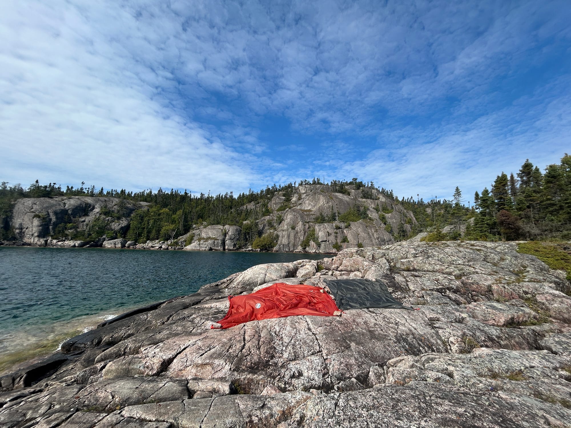
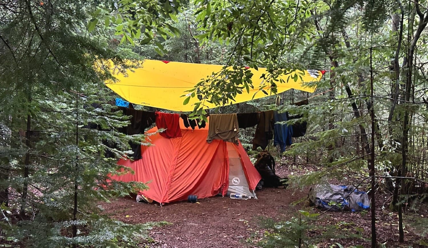
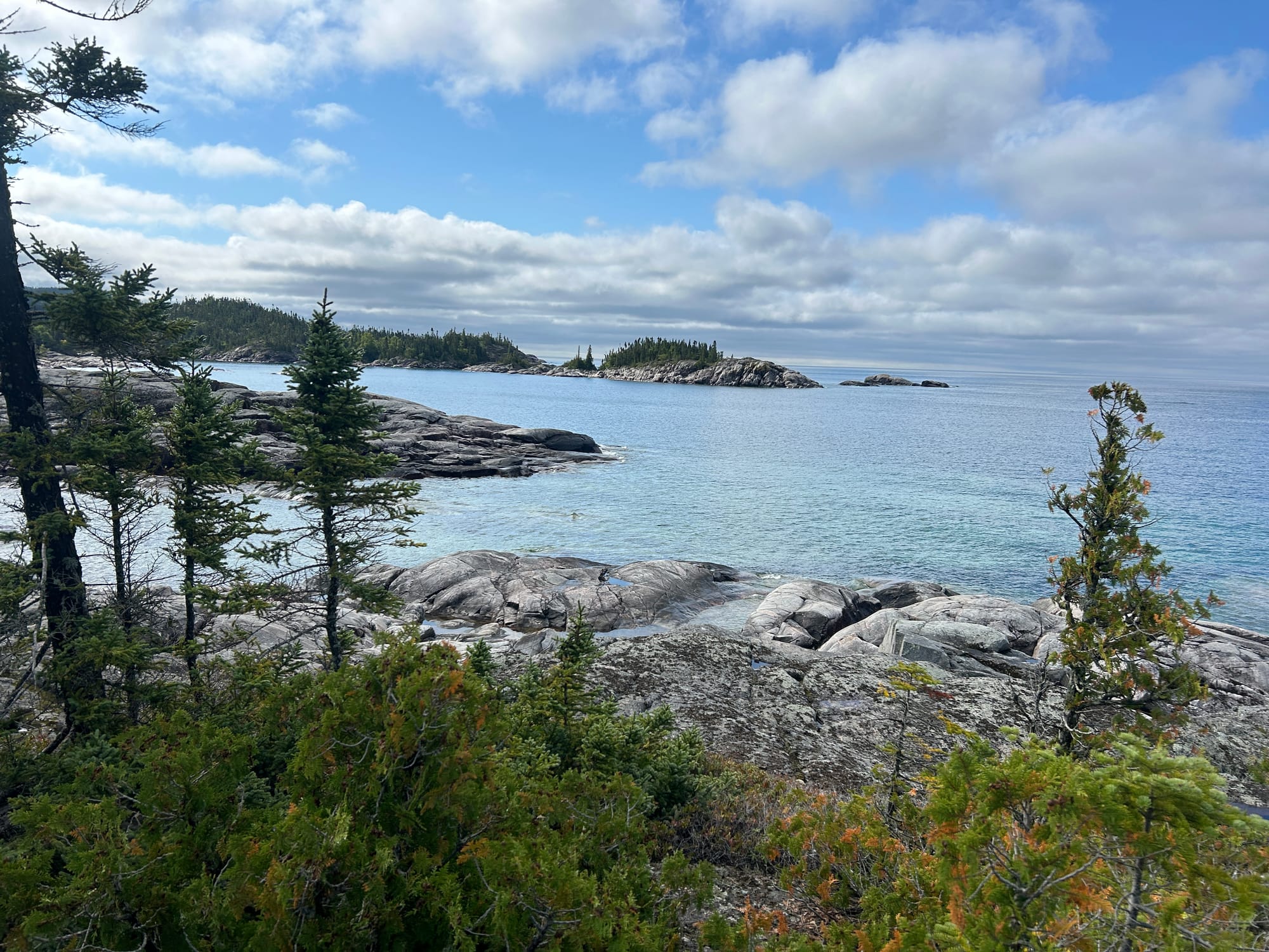
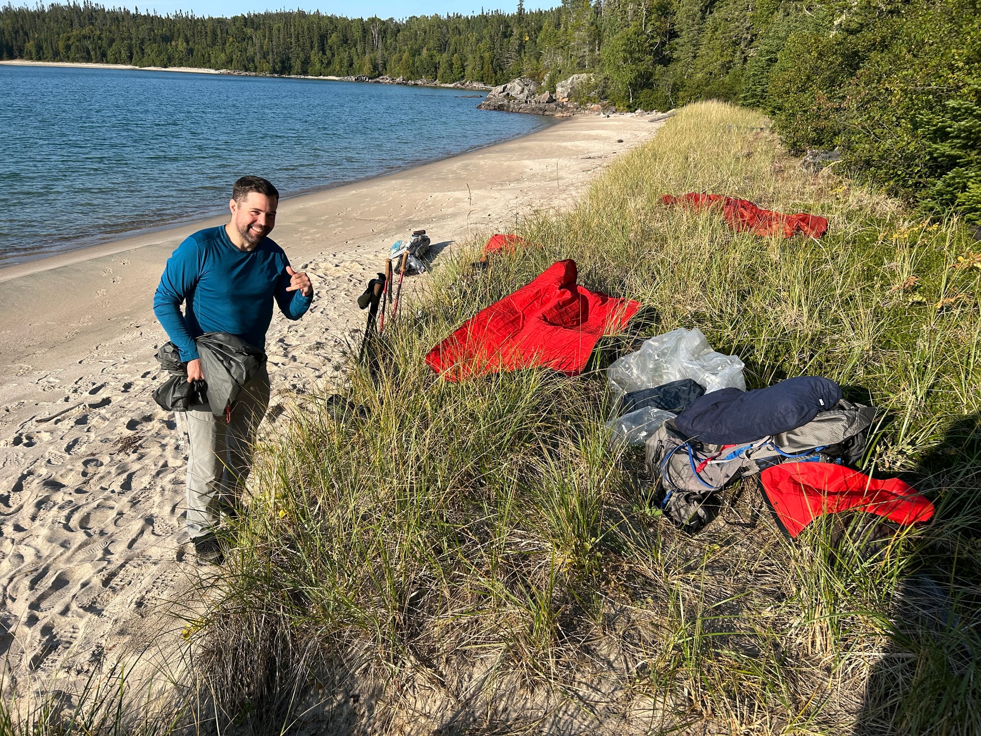
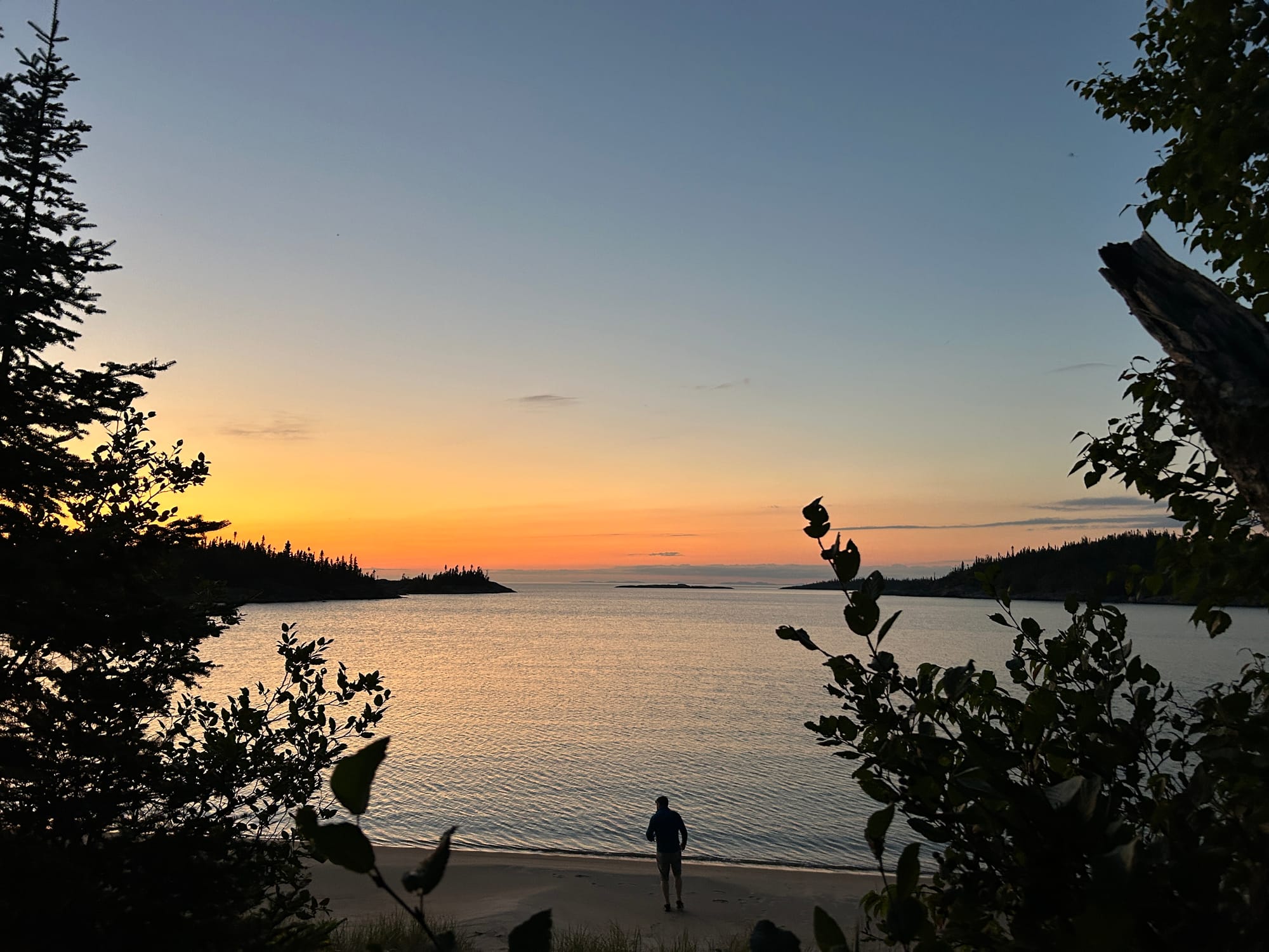
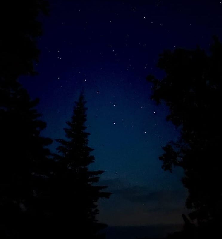
We arrived at Fish Harbor with an afternoon sun and perfect breeze on the beach. We took the opportunity to dry out everything we owned along the grass in the afternoon sun. Tent, fly, clothes, backpacks, sleeping bag…everything was laid out in the sun. We even braved the water for brief dip to clean off. We enjoyed a beautiful sunset with a clean night for stars. Truly a beautiful site.
Day 4 - Calm Watters Fish Harbor to Hook Falls
Distance 16 km
Travel Time 7.5 hrs
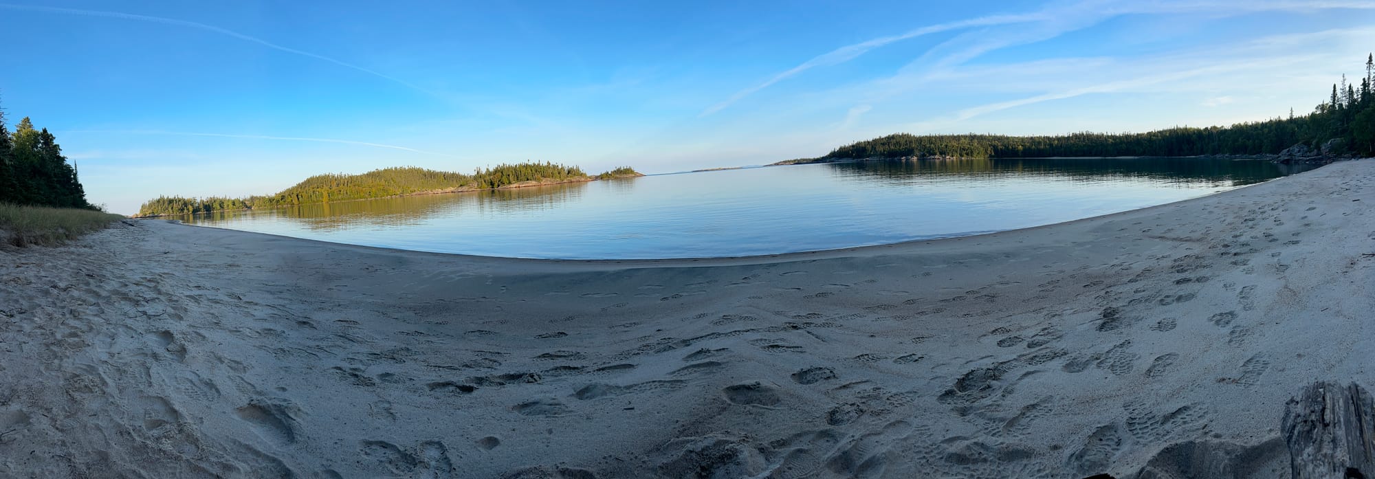
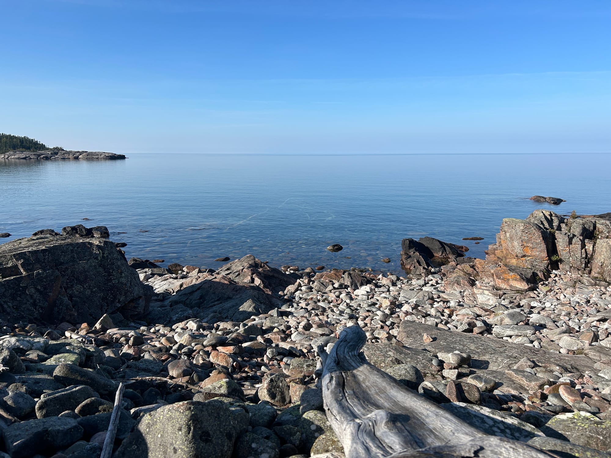
We awoke to a calm morning with waters like glass. We enjoyed a quiet coffee on the beach before getting underway.
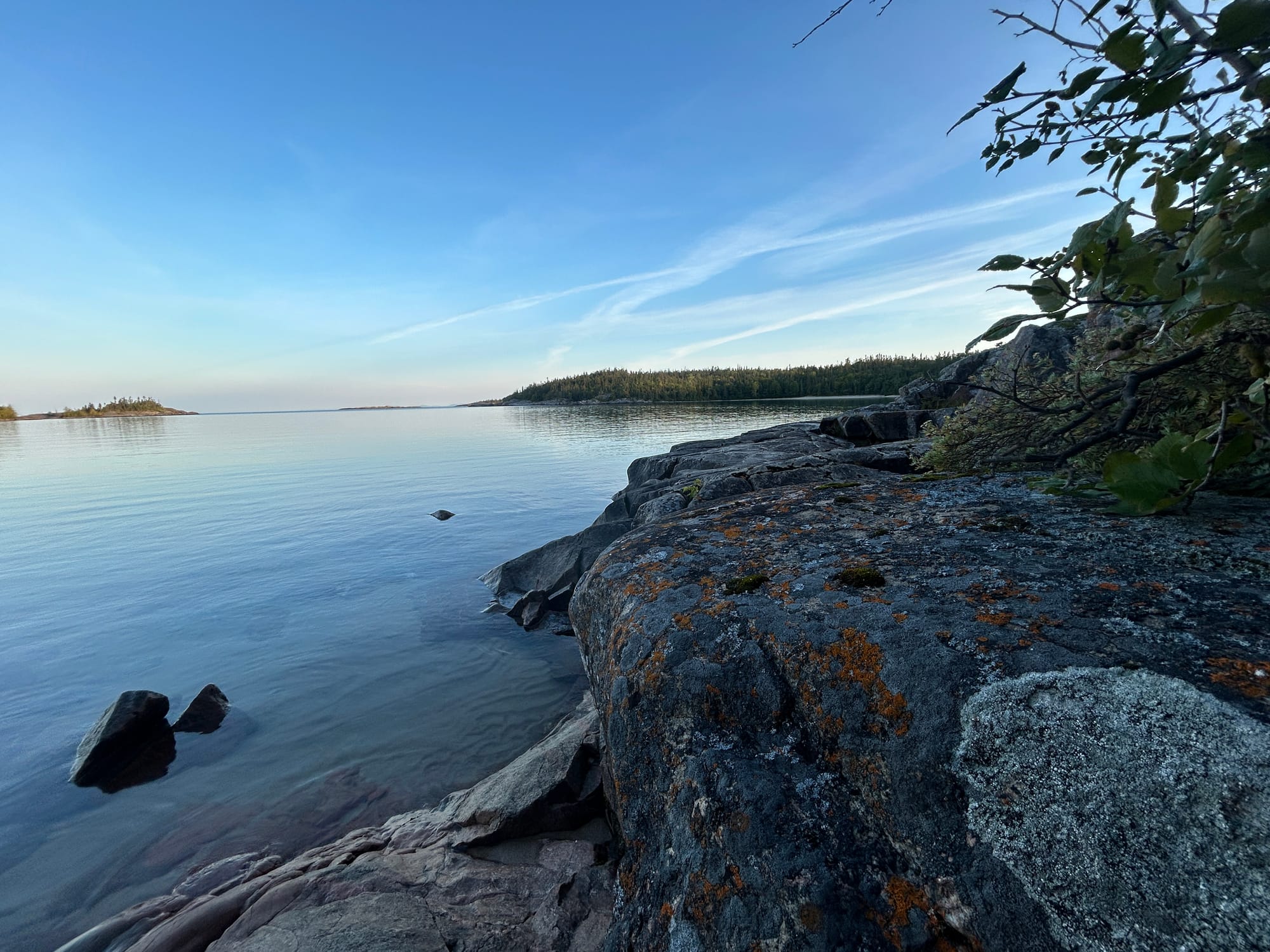
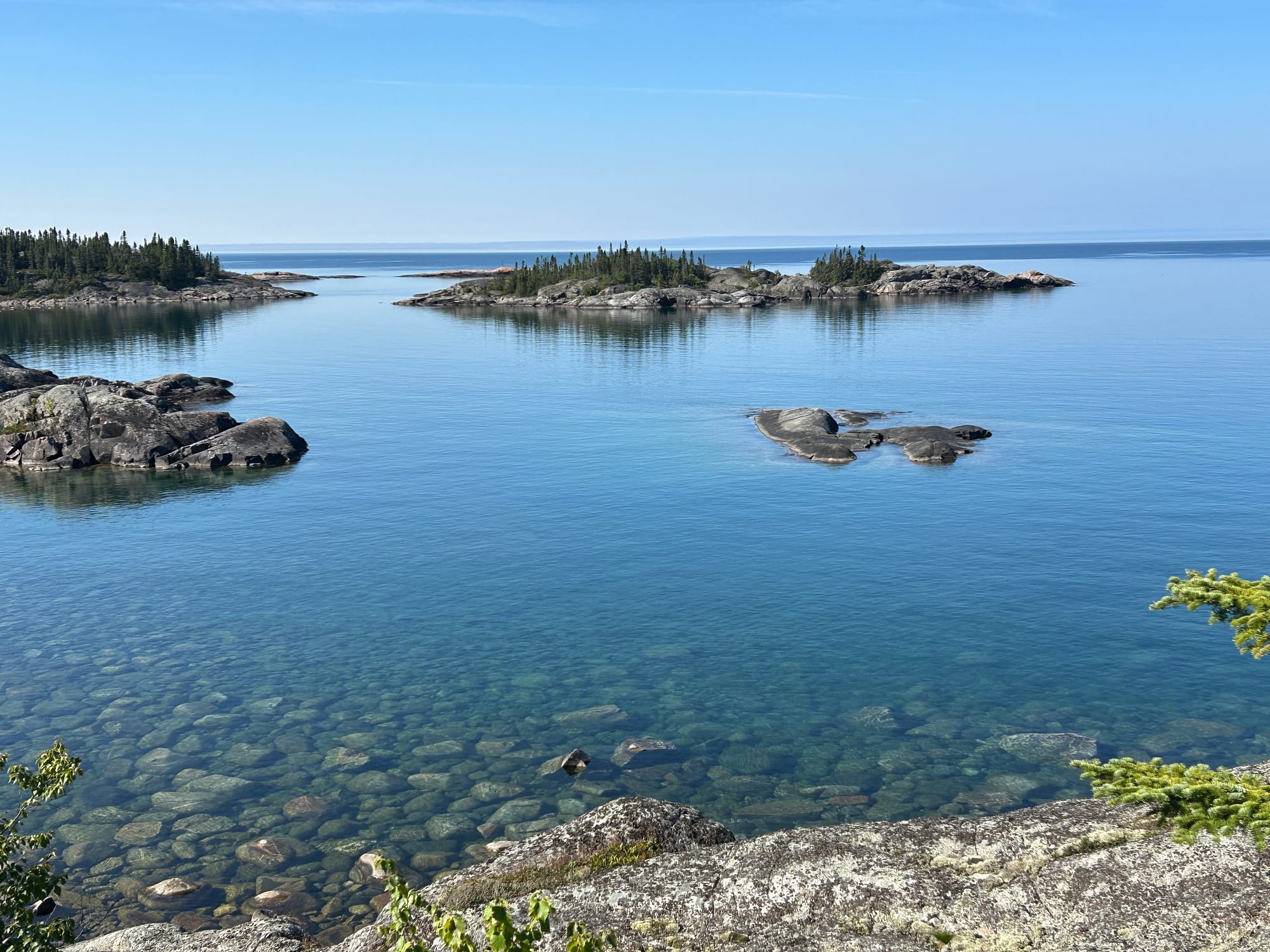
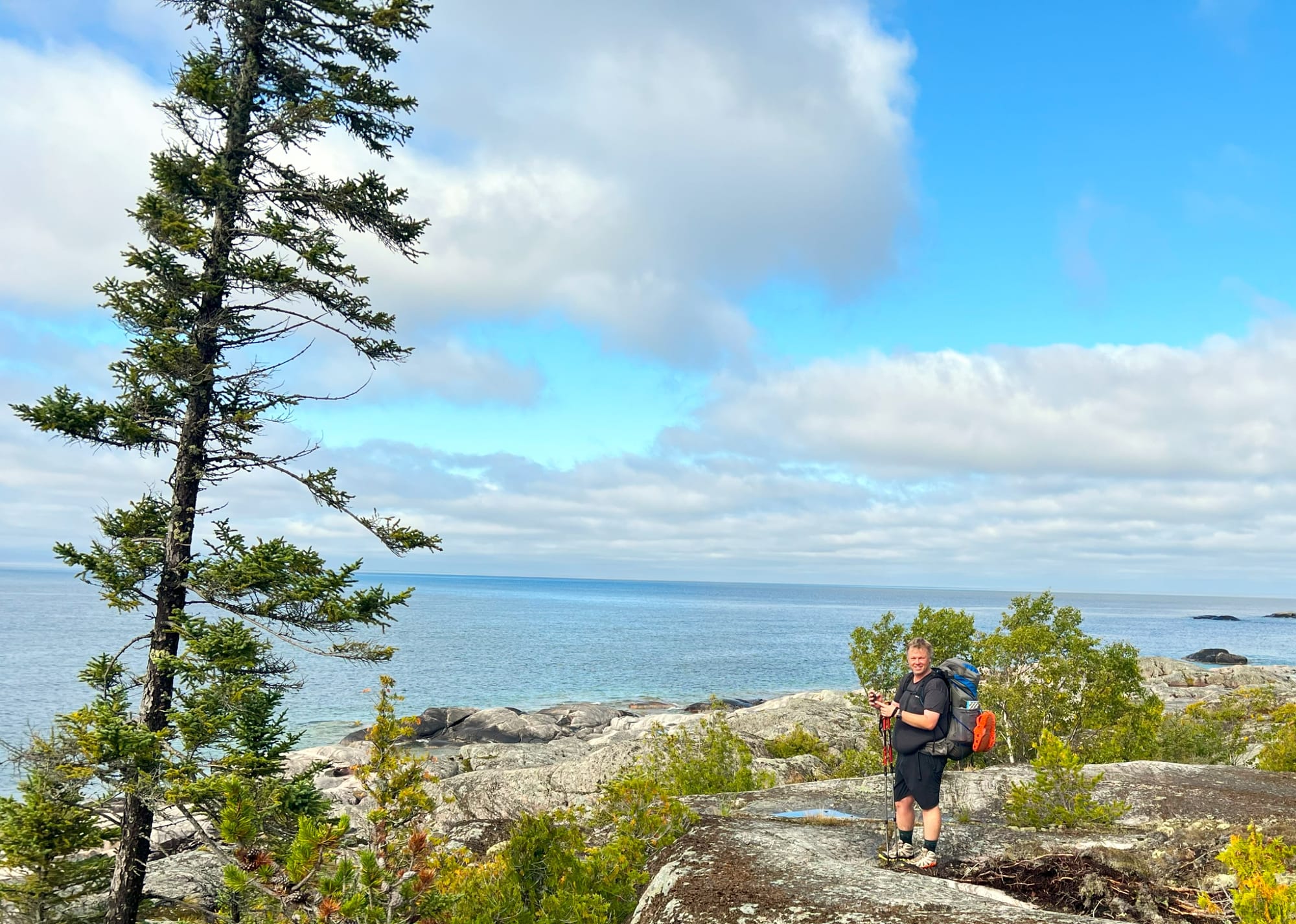
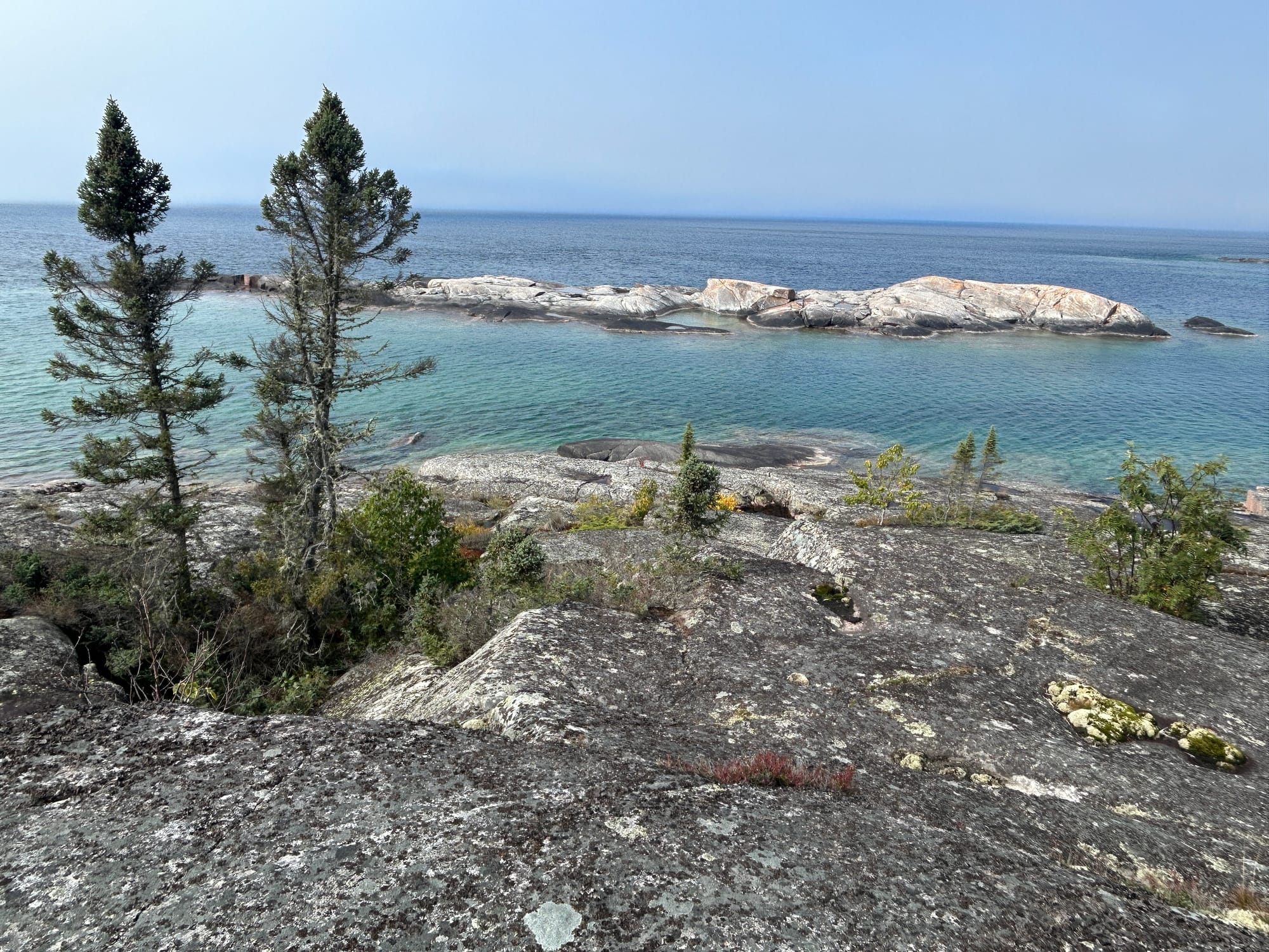
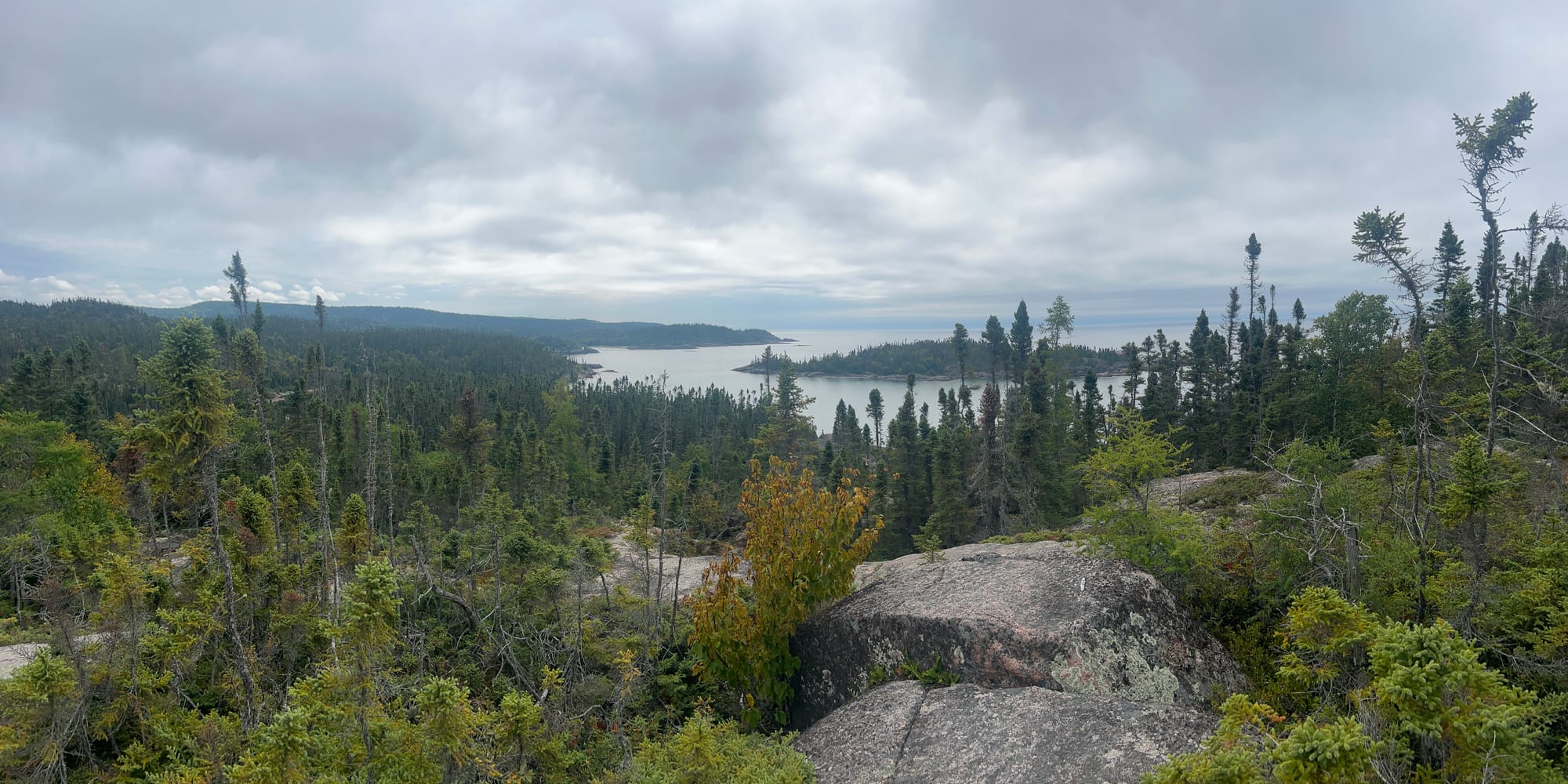
We worked our way around the coastline, gradually moving from sandy bays into rocky clambers. The trail in these areas was well marked with cairns dotted along the coast. When given the option to take the scenic route and continue along the shore, we took it and were treated with a glorious morning of shoreline hiking.
We climbed up and over rockfalls, rock hopped across boulders along the shore and descended smooth rock shores which would have become a dangerous slide in the wrong conditions. It was beautiful hiking with a slower pace which allowed us to take in the views. Just enjoy the eye candy and let these photos take you to those coastal views.
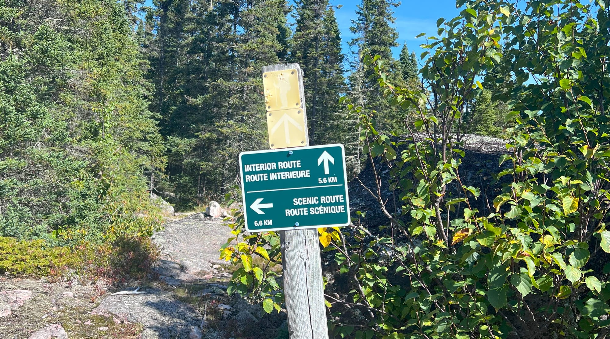
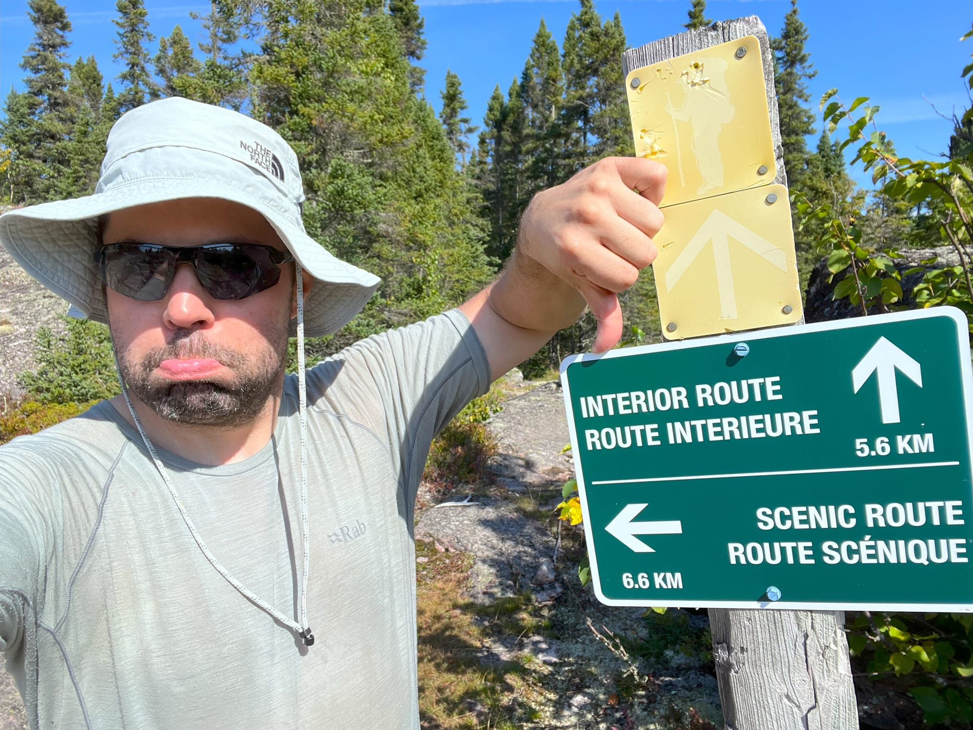
This sign caused confusion. The distances didn't line up with the map. The 6.5km scenic route appears to be a scant 3km on the trail map. It caused us to wonder if we had misread the distance we had left cover for the day. We didn't let it deter us from taking in the scenery.
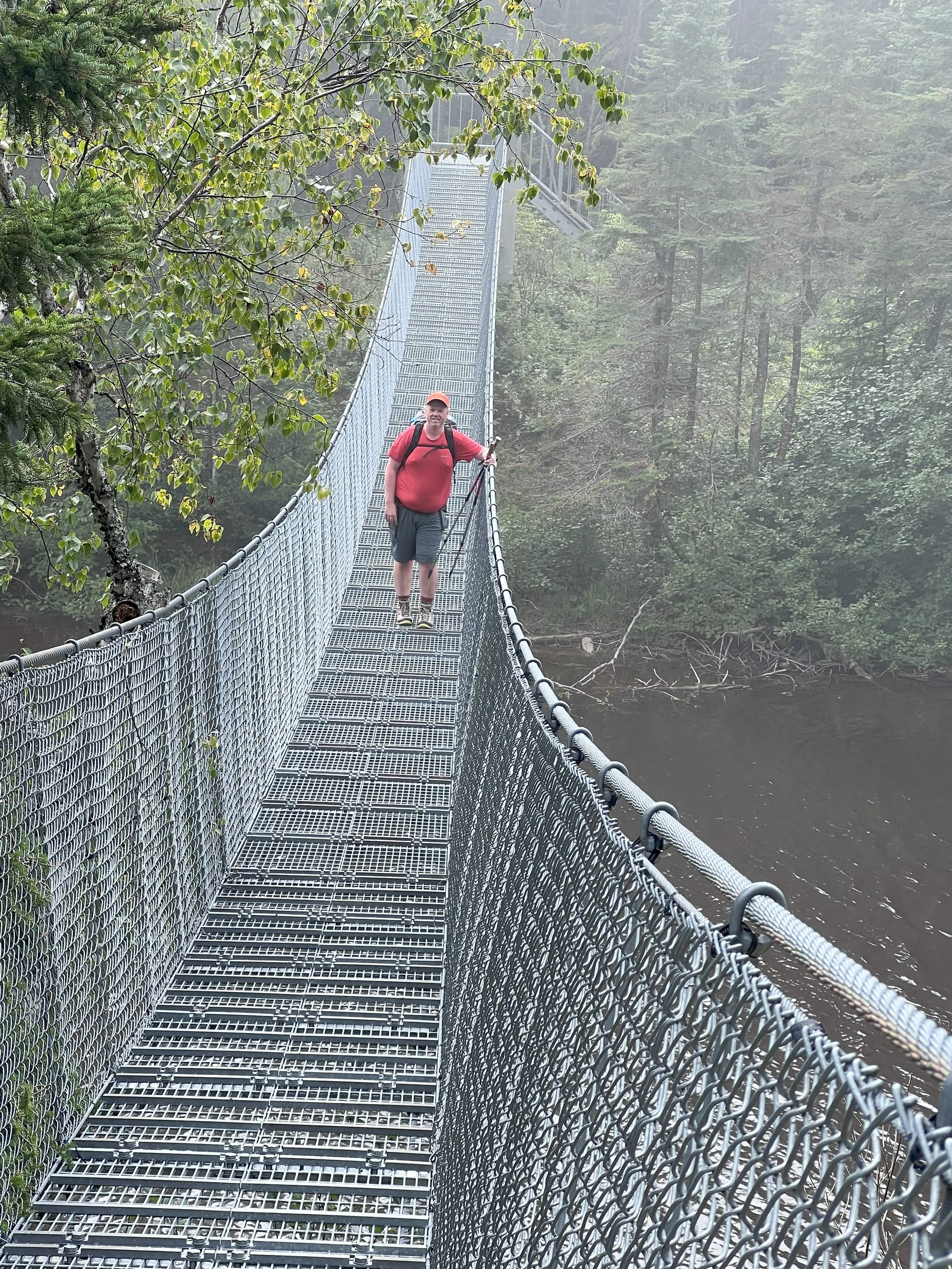
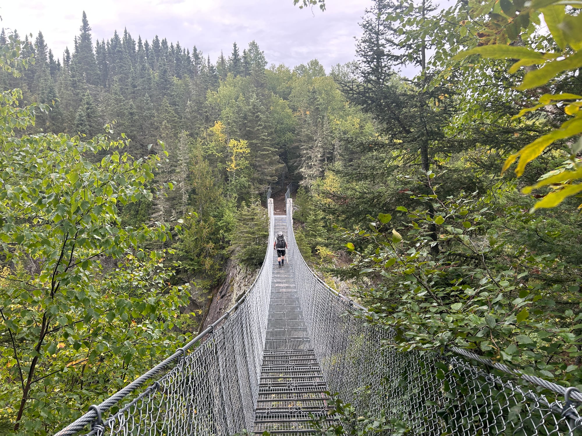
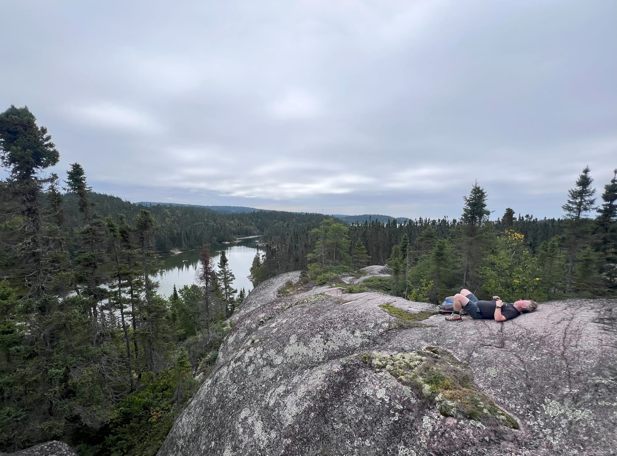
Shorty after rejoining the trail we arrived at the Willow River suspension bridge. A beautiful engineering marvel in the least likely of places. While not overly high elevation this bridge still shakes plenty while crossing and is merely an appetizer for tomorrows bridge.
We passed through the Willow River campsites shortly after. At this point the trail heads inland and we spent the rest of the day hiking through lush green forest. We arrived at Hook Falls just after 5:00 to find HF3 and HF2 were just a clearing in the forest. There was no privacy between the two and a group had already helped themselves to both sites. Exhausted from the day we were glad to find a flat clearing and share their campfire for the evening. They were a group of friends who were also on their annual trip. We spent the night sharing laughs and discussing other hikes out there. After our talk I suspect they will be heading to the West Coast Trail next year.
Day 5 - Final Push
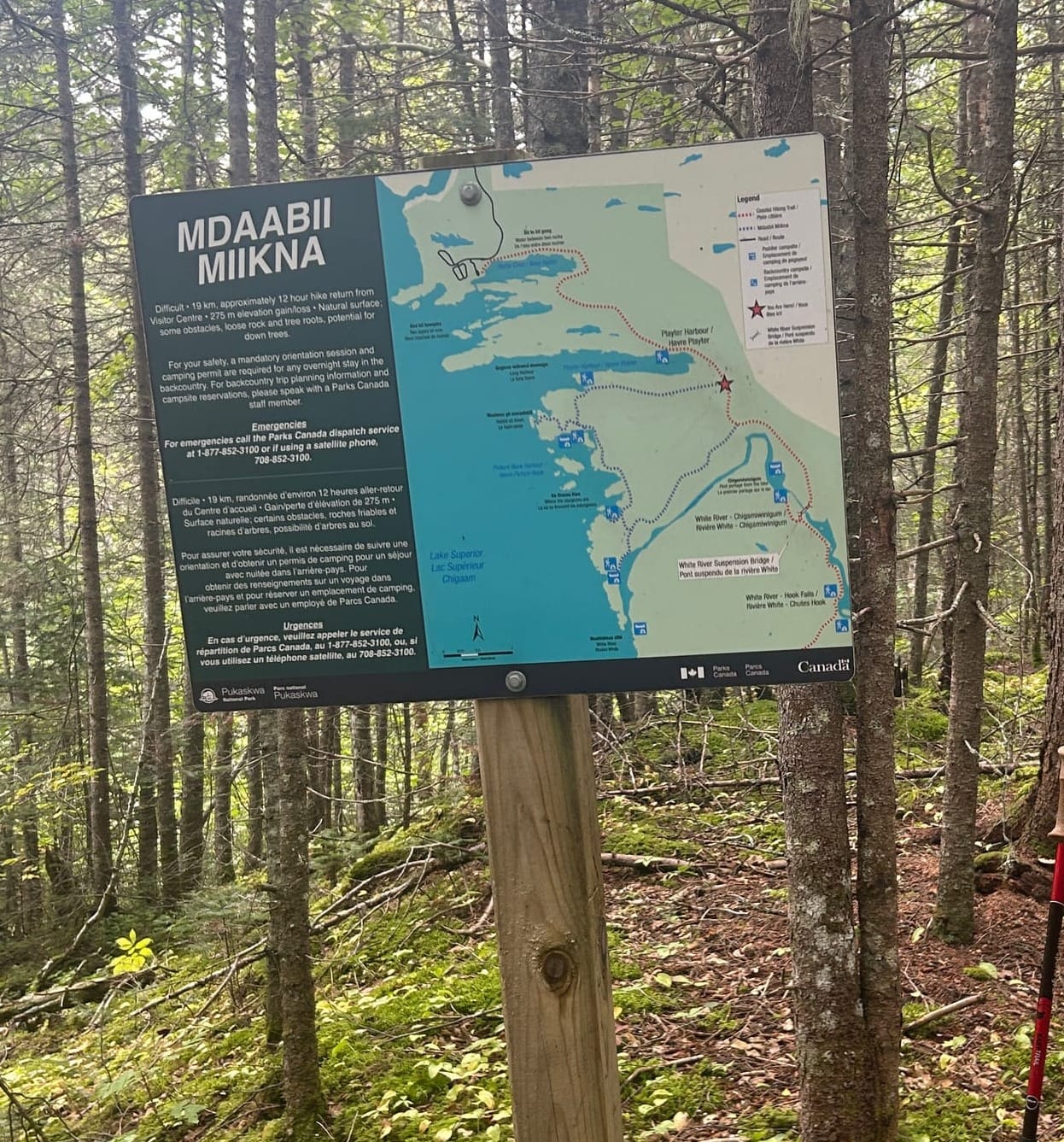
Hook Falls to Hattie Cove via the Mdaabii Miikna Trail
Est ~19km
8.5hrs
On our final morning, we bid farewell to the Hook Falls. I strongly recommend to avoid staying at HF2 & HF3. The site was my least favorite. We were hemmed in by trees with no views and poor water access. The morning brought us down to a viewpoint of the falls. There were a few well made wood bridges on this stretch of trail, it felt like the going would get easier. (Spoiler - I was wrong for thinking that)
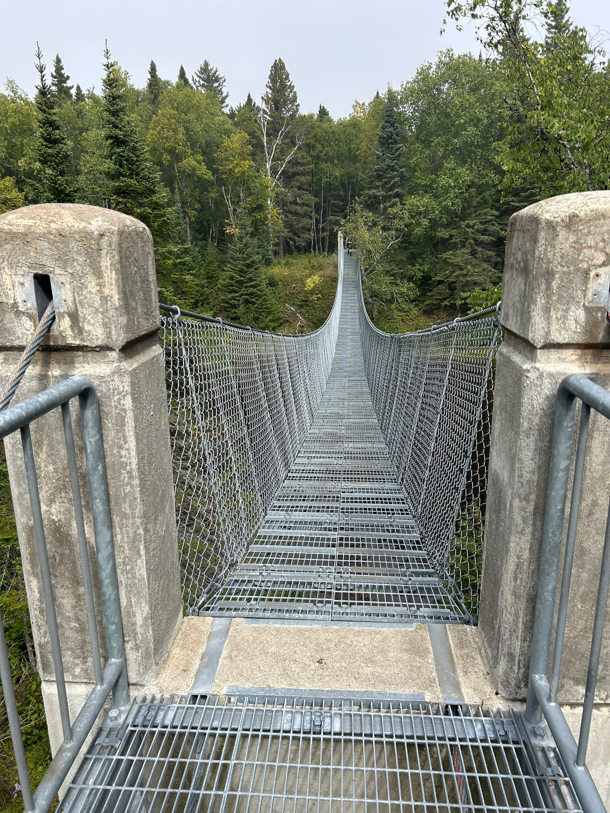
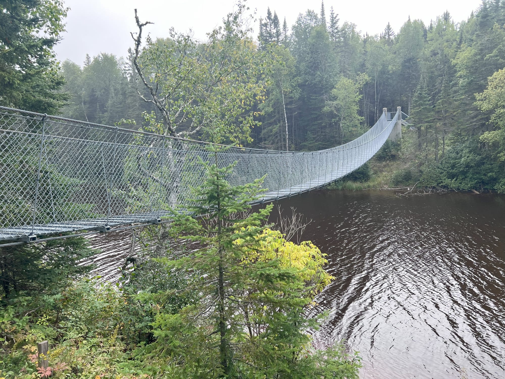
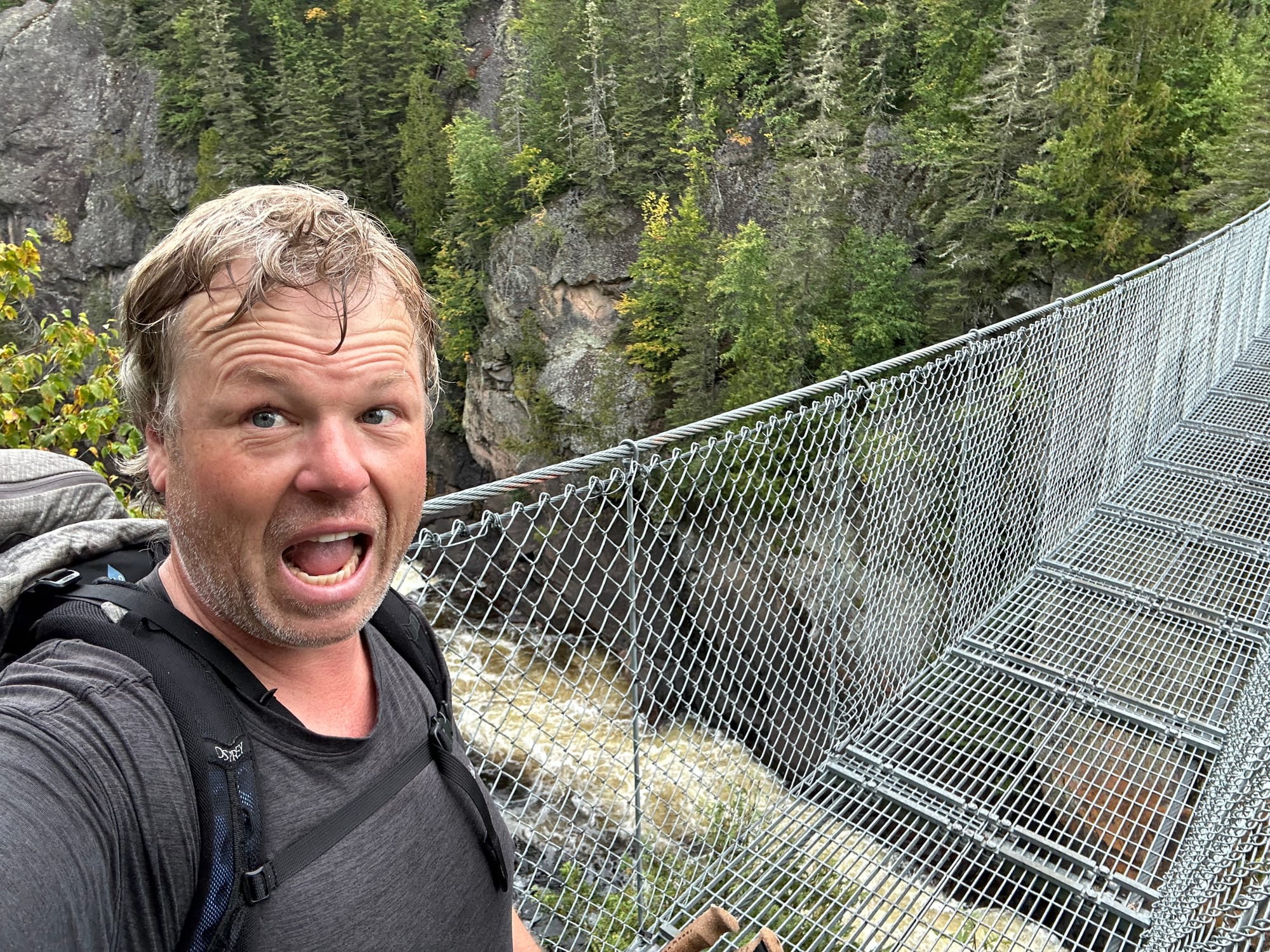
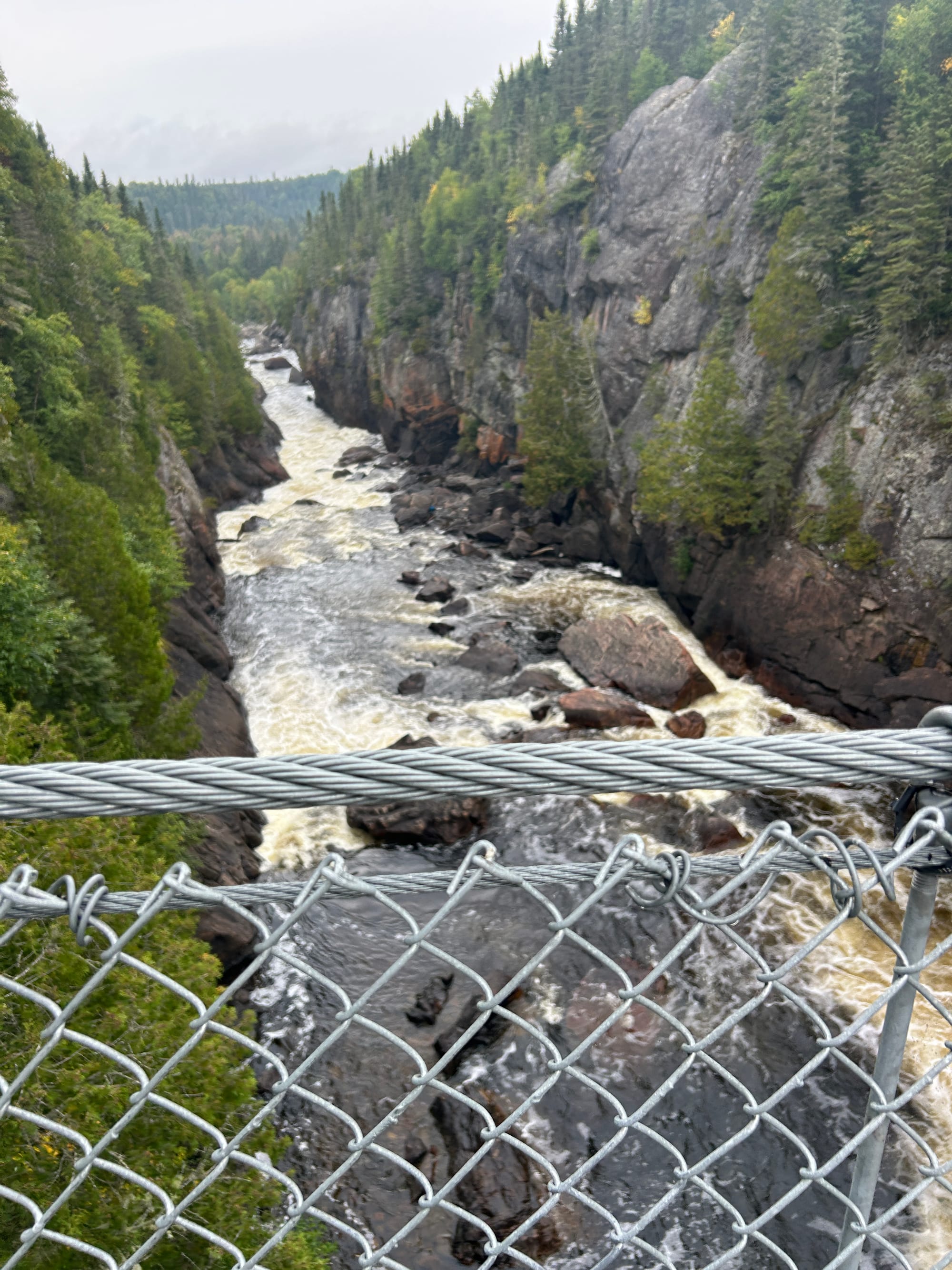
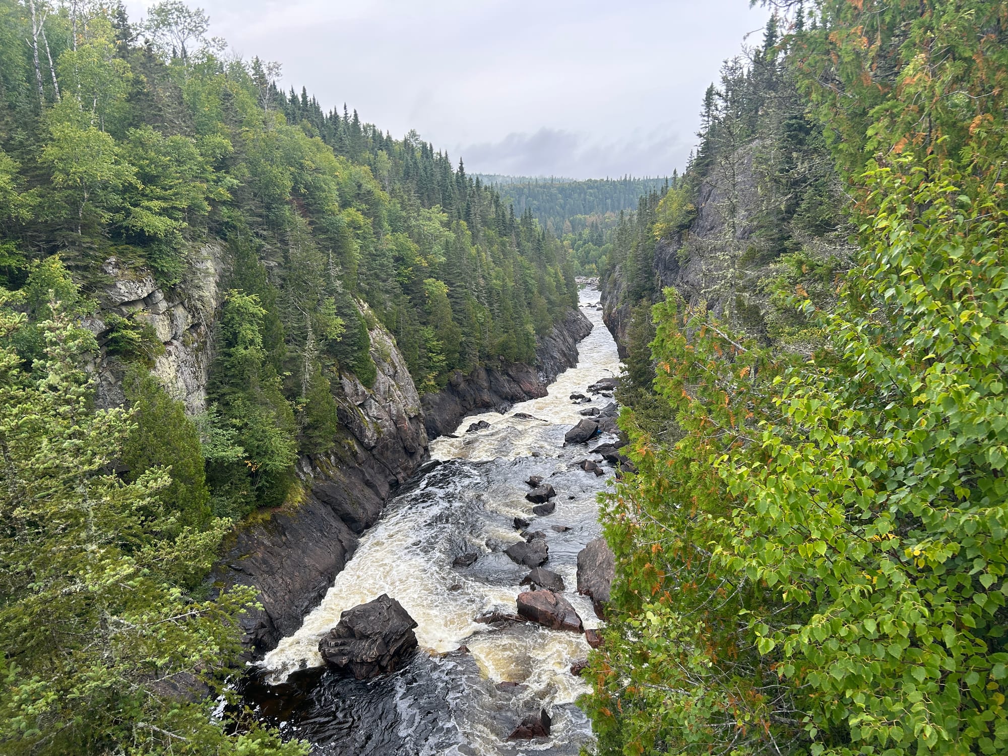
The White River suspension bridge is fantastic. It does shake while you are on it but the scenery looking up and down river was fantastic. Look at these shots:
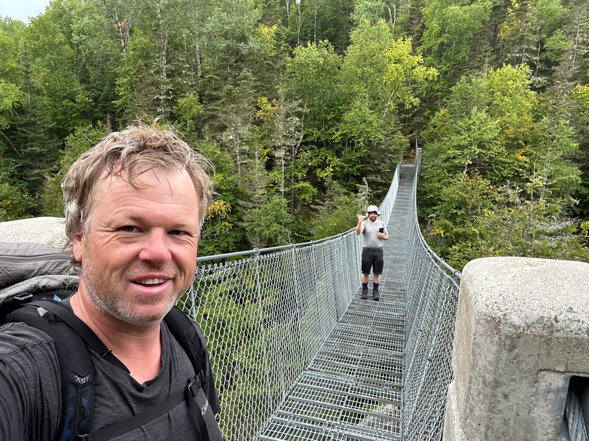
After ogling the bridge and debating how they transported all the materials to this location we marched on. Hook Falls to the trailhead is 8.8km but we weren’t planning to drive home until the next day and there was no rain in the forecast so we decided to add in the optional loop of the Mdaabii Miikna. This branches off the main trail, the first 3 km were wide, flat and well kept. It was some of the easiest hiking we had experienced. My spirits high, thinking we had made the right choice.
As you near the lake and turn North the trail becomes rocky shorelines with plenty of elevation changes and areas that require extra precautions. You must pay attention to your footing and progress slows down.
Here is a rocky chute where you get to crawl under a massive boulder.
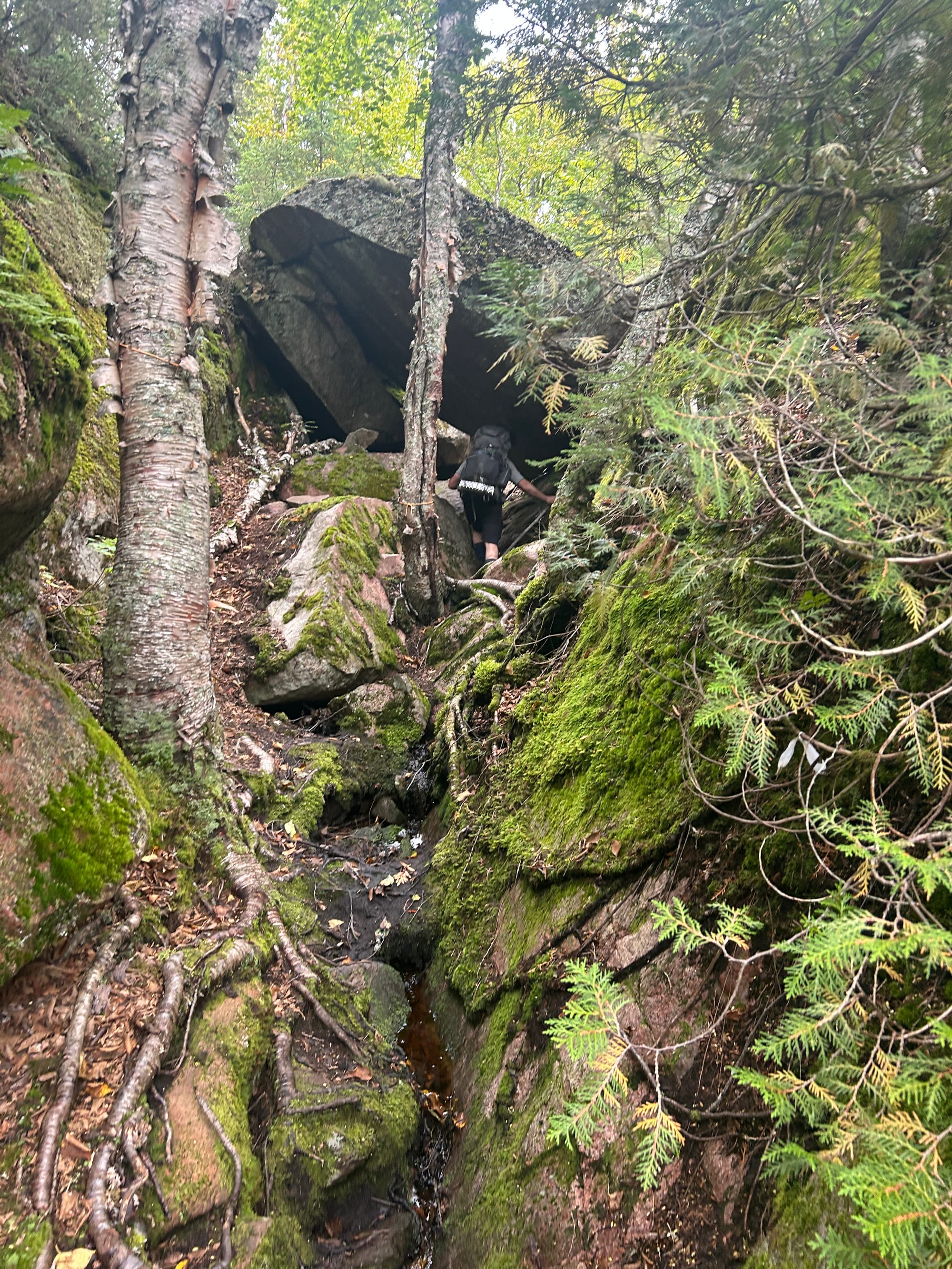
You rise up to experience coastal views and then wind your way back into the forest. As you can see, my body was feeling the effects of the days. We did see a few other hikers out on the trail, one couple with several small dogs. I hope they managed ok. I would not recommend bringing your dog. Finally by mid afternoon we joined back on the main trail and estimated a mere 5km back to Hattie Cove.
Mdaabii Miikna Trail - My thoughts
A challenging route, similar to many parts of the coastal trail. I’m glad we were able to work it into our plans. The views were great but fell short from many of the coastal scenes we had already experienced.
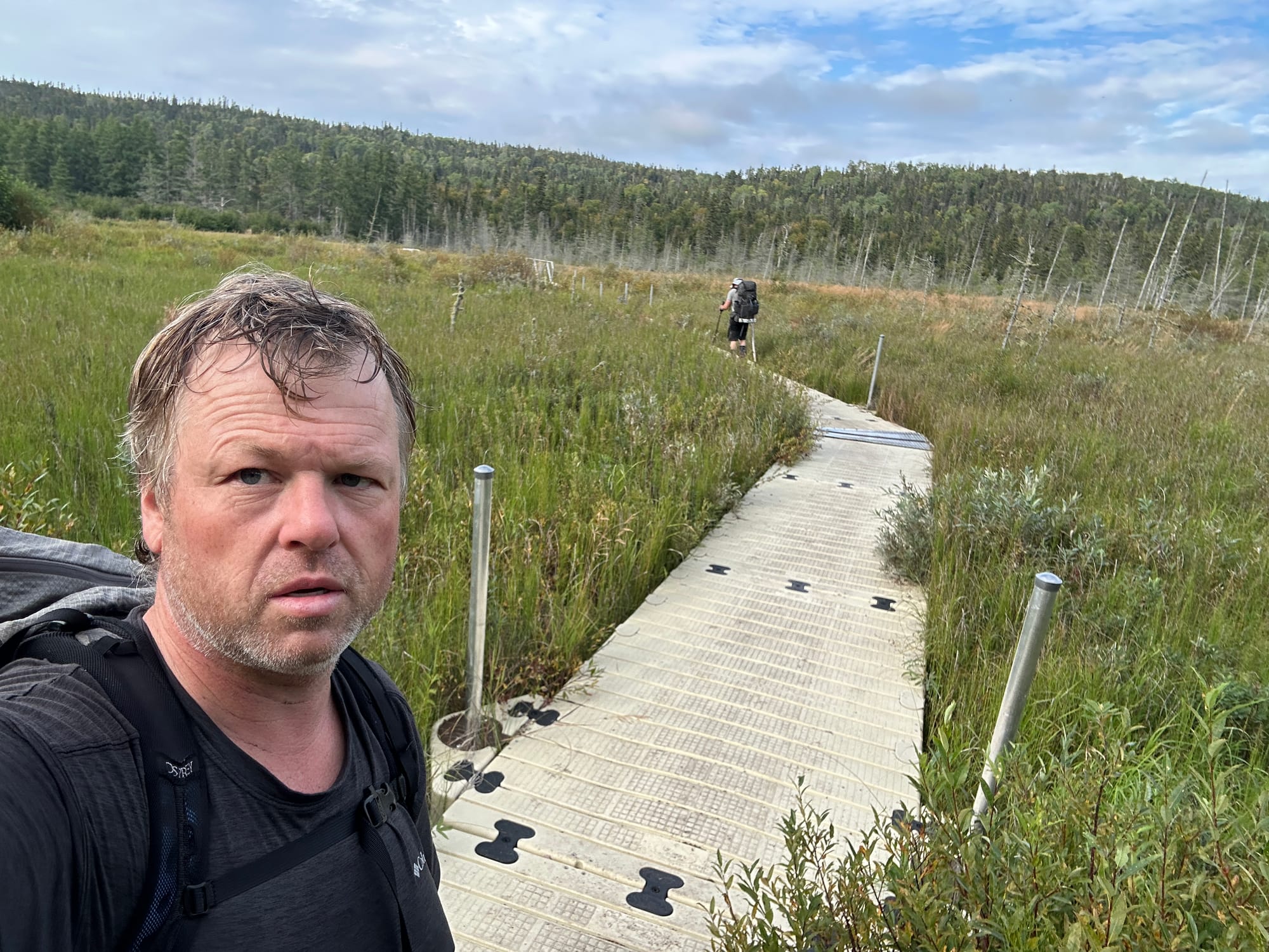
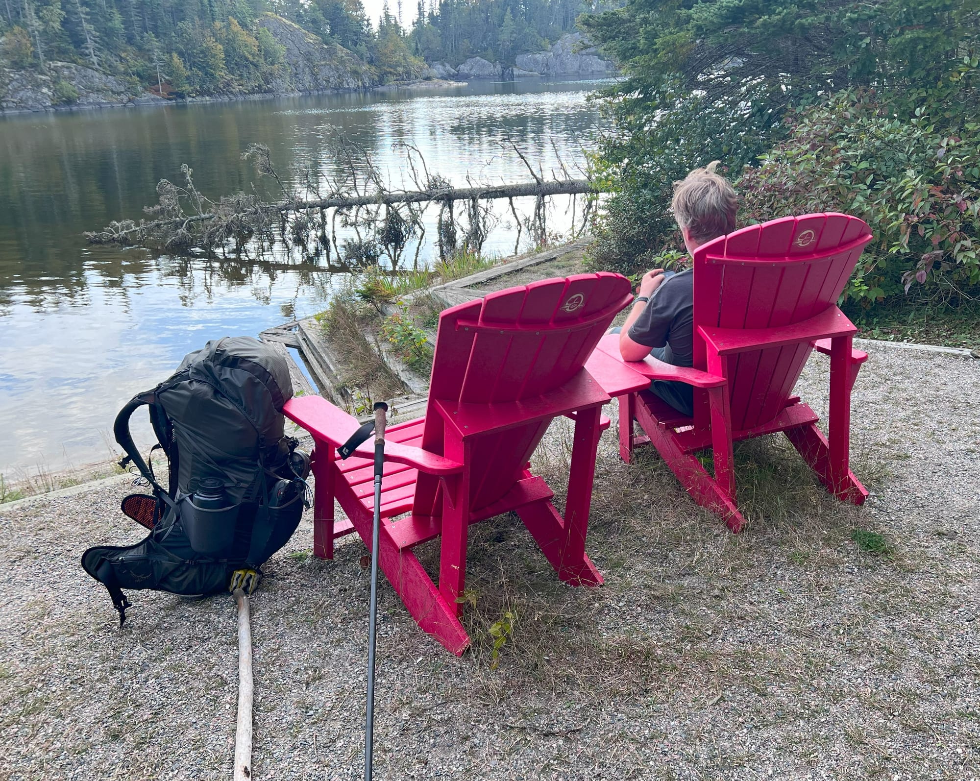
I was tired and sore and ready for a hot shower. I thought as we neared the visitors center and civilization the terrain would get remarkably easier going. However the Coastal Trail has a way of keeping you humble. Although there were better sections, there were plenty of obstacles in the form of water, mud and rocky ascents. The trail follows the shores of Hattie Cove and we arrived at the floating boardwalks which take you through wetlands. We kept hoping to see the visitors center around each corner as we gradually made our way up the opposite shores. We finally arrived back at the trailhead and took a rest on the red chairs just down from the visitor’s center where Doug had picked us up 5 days earlier.
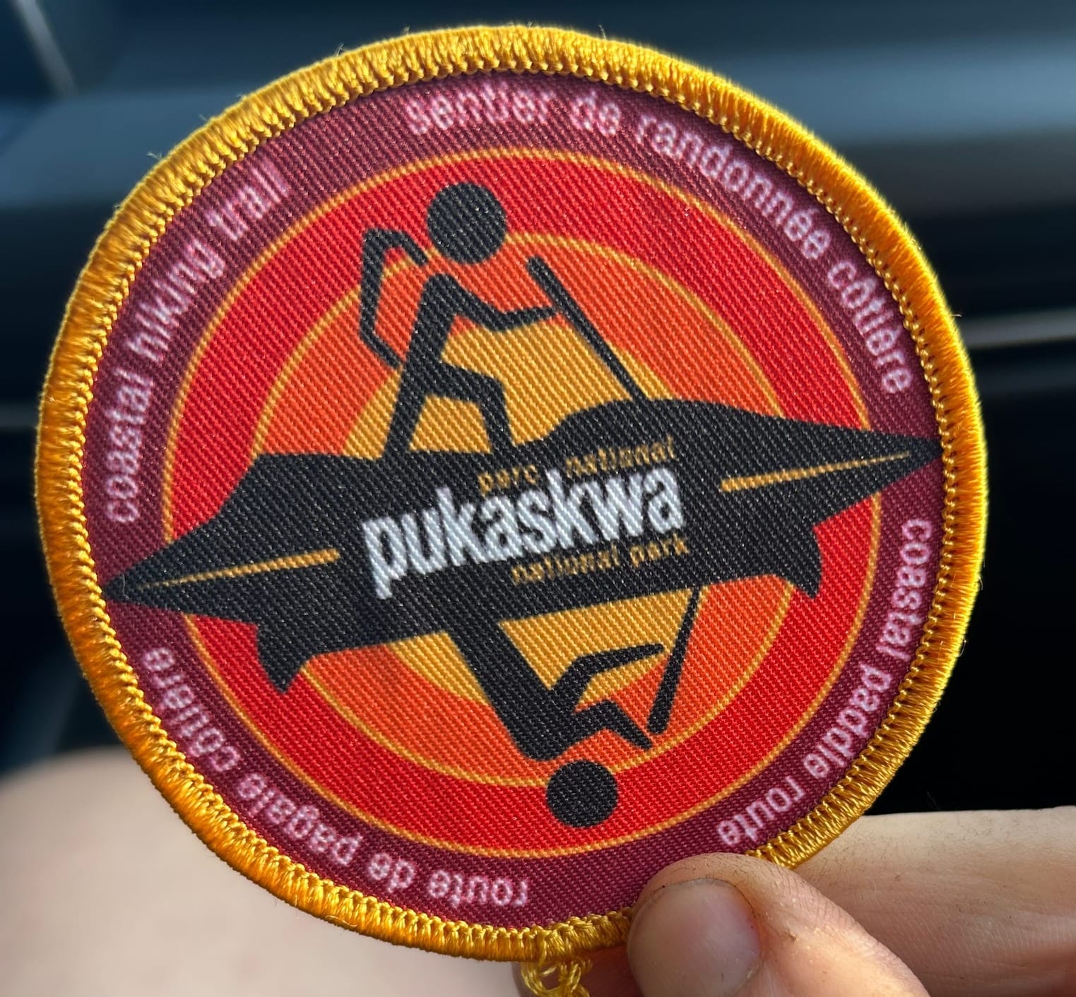
We reported to the front desk to de-register so they know we are accounted for and retrieved our complimentary patches. After snacks and a hot shower I felt remarkably better. We had one last dehydrated dinner at our campsite and had an early night at Hattie Cove. The next day we got on the road for the long drive back.
That rounds up our 2025 trip to the Pukaskwa Coastal Trail. If you are looking for a challenge then get out there and experience the Puk for yourself.